
TROPICAL STORM ARTHUR FORMS OFF FLORIDA, WARNINGS ISSUES FOR OUTER BANKS OF NORTH CAROLINA
The first named storm of the Atlantic hurricane season formed off the Florida coast yesterday, making it the sixth-straight year for a system to develop before the official start of the season as tropical storm warnings were issued for North Carolina’s Outer Banks.
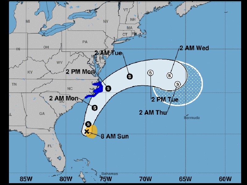
The U.S. National Hurricane Center (NHC) said Tropical Storm Arthur has maximum sustained winds of 40 mph as of 5 a.m. this morning, and is located about 355 miles south-southwest of Cape Hatteras, North Carolina. The storm is moving north-northeast at 9 mph away from the United States. The storm could come up against the North Carolina coast.
A tropical storm warning has been posted from Surf City to Duck, North Carolina, including the Pamlico and Albermarle Sounds.
The tropical storm is forecast to turn toward the northeast with an increase in forward speed over the next 24 to 48 hours.
Forecasters said some strengthening is in the forecast during the next 48 hours, but Arthur is likely to lose its tropical characteristics on Tuesday. Tropical-storm force winds extend outward up to 80 miles from the center of the storm.
The 2020 Atlantic Hurricane Season runs from June 1 to Nov. 30 and will include the names: Arthur, Bertha, Cristobal, Dolly, Edouard, Fay, Gonzalo, Hanna, Isaias, Josephine, Kyle, Laura, Marco, Nana, Omar, Paulette, Rene, Sally, Teddy, Vicky, and Wilfred.