SEVERE STORM THREAT FOR CROSSVILLE WEDNESDAY INTO THURSDAY

The National Weather Service in Nashville and the Storm Prediction Center are highlighting a risk for severe thunderstorms in the Crossville area beginning Wednesday evening and continuing into Thursday.
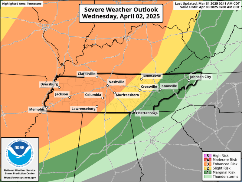
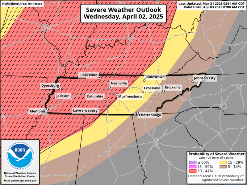
On Wednesday, Crossville is included in a Level 2 (Slight Risk) area for severe weather. The Storm Prediction Center also places the region in a 30% probability zone for severe weather occurring within 25 miles of a given point. A hatched area over the region indicates a 10% or greater chance of significant severe weather, which may include damaging winds, large hail, or tornadoes.
Forecasters caution that this risk is highly conditional. The position of a frontal boundary expected to stall northwest of the region will determine how much of the severe weather threat reaches the Plateau. If the front stays farther north, storms may remain out of the area. If it shifts south, Crossville could be affected.
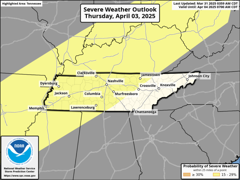
The risk appears to lessen on Thursday, when Crossville is included in a Level 1 (Marginal Risk) area, with a 15% probability of severe weather.
The public is encouraged to monitor updates from the National Weather Service, as the situation remains uncertain and subject to change.
Local weather updates can be heard on:
-
105.7 The Hog
-
Spirit 101.9
-
94.1 The Vibe (1410 AM)
-
98.9 The Wolf
-
93.3 The Ranch (580 AM)
Source: National Weather Service Nashville / Storm Prediction Center