
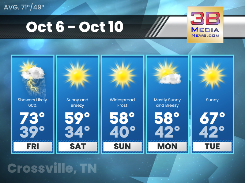
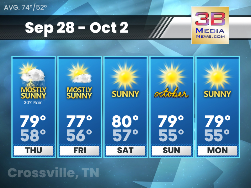
Friday’s 5-Day Forecast
Some showers and thunderstorms around Friday into Friday night. Much cooler temperatures through the weekend followed by a gradual warming trend. Friday: Showers likely before 1pm, then a chance of s ...
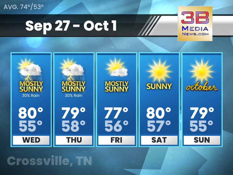
Thursday’s 5-Day Forecast
Increasing clouds Thursday but dry and warm weather continues. Cooler, fall-like temperatures arrive over the weekend. Patchy frost for parts of the Plateau both Saturday and Sunday nights. Thursday: ...
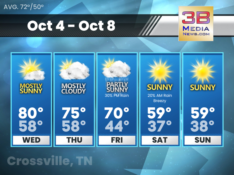
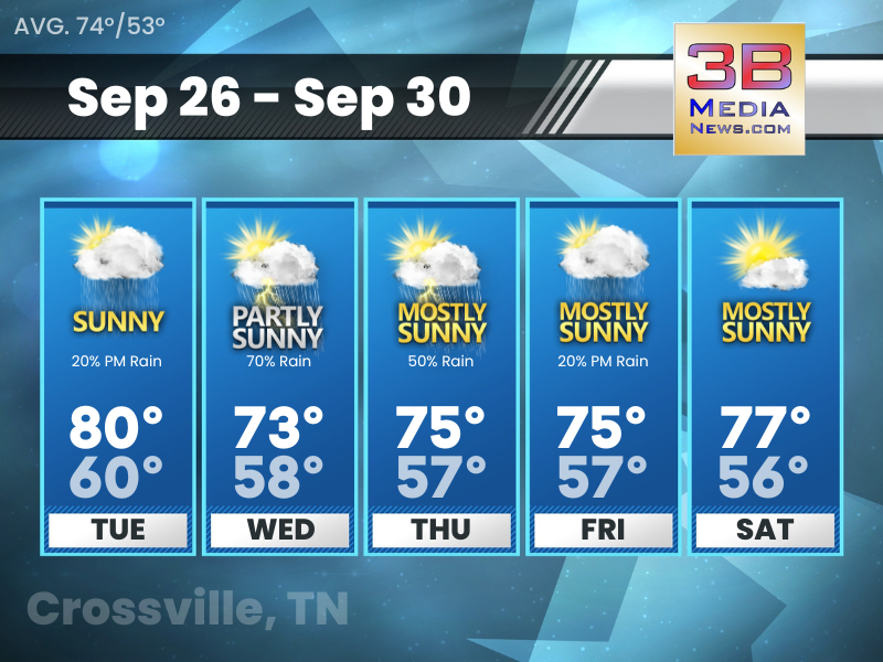
Wednesday’s 5-Day Forecast
Chances of showers Thursday night through Saturday. Major cool down over the weekend. Wednesday: Mostly sunny, with a high near 80. South wind around 5 mph. Wednesday Night: Increasing clouds, with ...
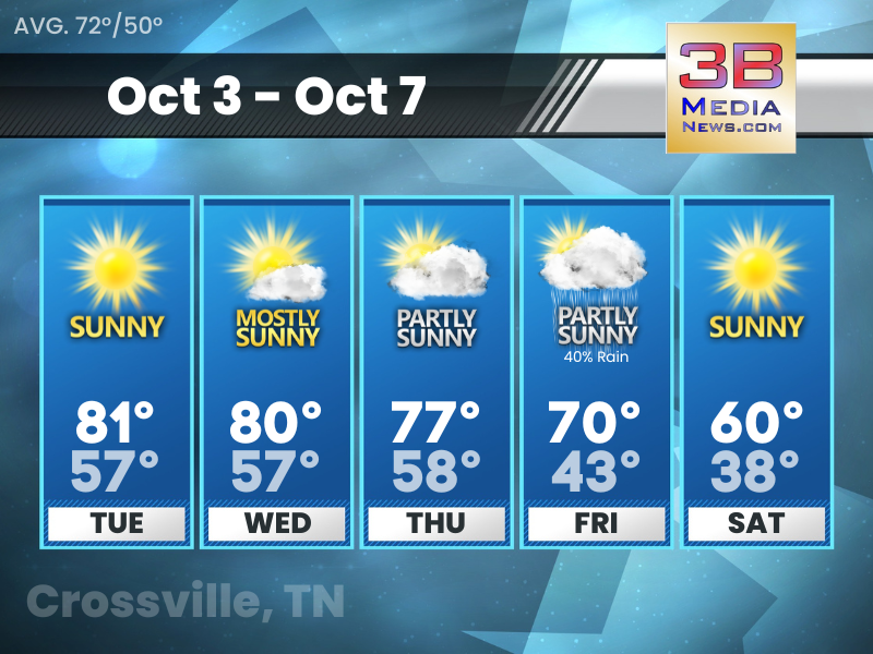
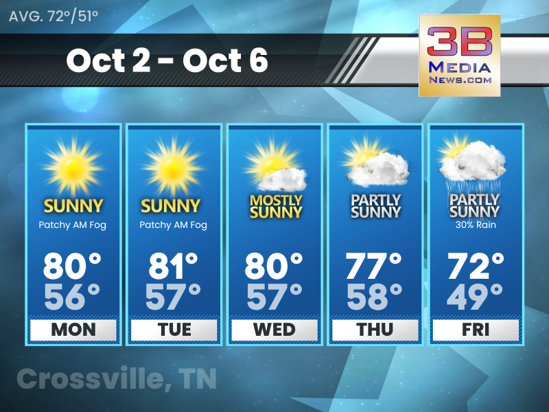
Tuesday’s 5-Day Forecast
Fall truly sets in (or least arrives) this weekend. Tuesday: Sunny, with a high near 81. Calm wind becoming south around 5 mph. Tuesday Night: Mostly clear, with a low around 57. Calm wind becoming ...
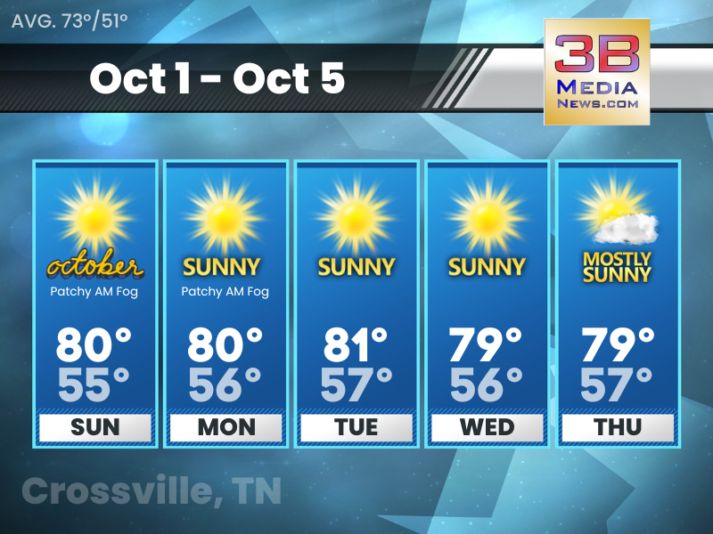
Monday’s 5-Day Forecast
Dry and unseasonably very warm conditions will be the rule throughout much of the week. A chance of showers return late in the week into next weekend. Monday: Patchy fog before 7am. Otherwise, sunny, ...
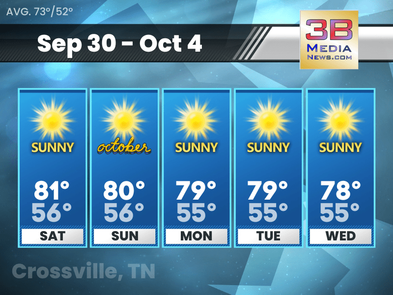
Sunday’s 5-Day Forecast
Sunday: Patchy fog before 8am. Otherwise, sunny, with a high near 80. Calm wind becoming south southeast around 5 mph in the afternoon. Sunday Night: Clear, with a low around 55. East northeast wind ...

Dense Fog Advisory
The National Weather Service has issued a Dense Fog Advisory for Clay County, Clinton County, Cumberland County, Fentress County, Overton County, Pickett County, Putnam County, Van Buren County, Wayne ...
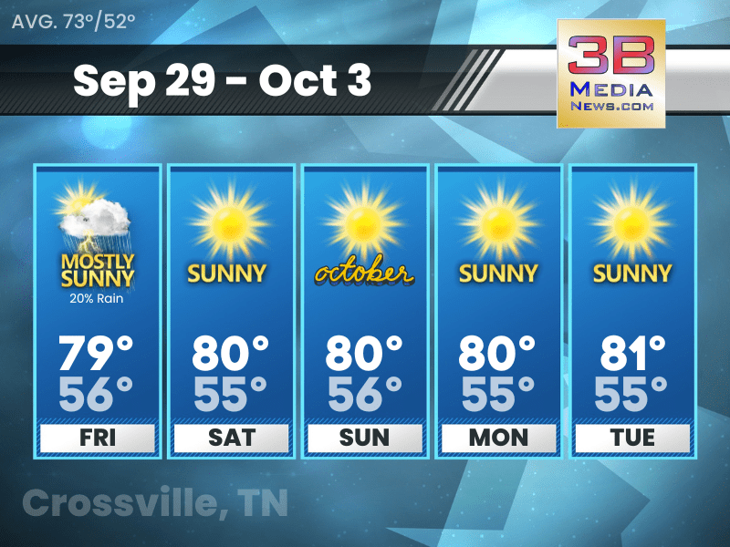
Saturday’s 5-Day Forecast
Saturday: Sunny, with a high near 81. Calm wind becoming northeast around 5 mph in the morning. Saturday Night: Mostly clear, with a low around 56. Northeast wind around 5 mph. Sunday: Sunny, with a ...
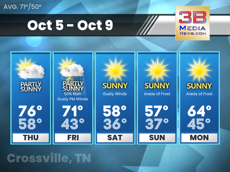
Friday’s 5-Day Forecast
Friday: A slight chance of showers and thunderstorms before 8am, then a slight chance of showers between 8am and 10am. Mostly sunny, with a high near 79. South southwest wind around 5 mph becoming nor ...
Thursday’s 5-Day Forecast
A chance of showers and storms late week before trending dry into the weekend. Continued dry conditions and slightly above normal temperatures expected next week. Thursday: A slight chance of showers ...
Wednesday’s 5-Day Forecast
Hazardous Weather Outlook: Scattered showers and storms are forecast this afternoon into the evening hours, especially near and north of Interstate 40. A few storms could be strong to severe along the ...
Tuesday’s 5-Day Forecast
Tuesday: A 20 percent chance of showers after 4pm. Sunny, with a high near 80. East southeast wind around 5 mph. Tuesday Night: A slight chance of showers and thunderstorms before 10pm, then a slight ...