
CLOUDY START TO NOVEMBER BEFORE MIDWEEK RAIN RETURNS
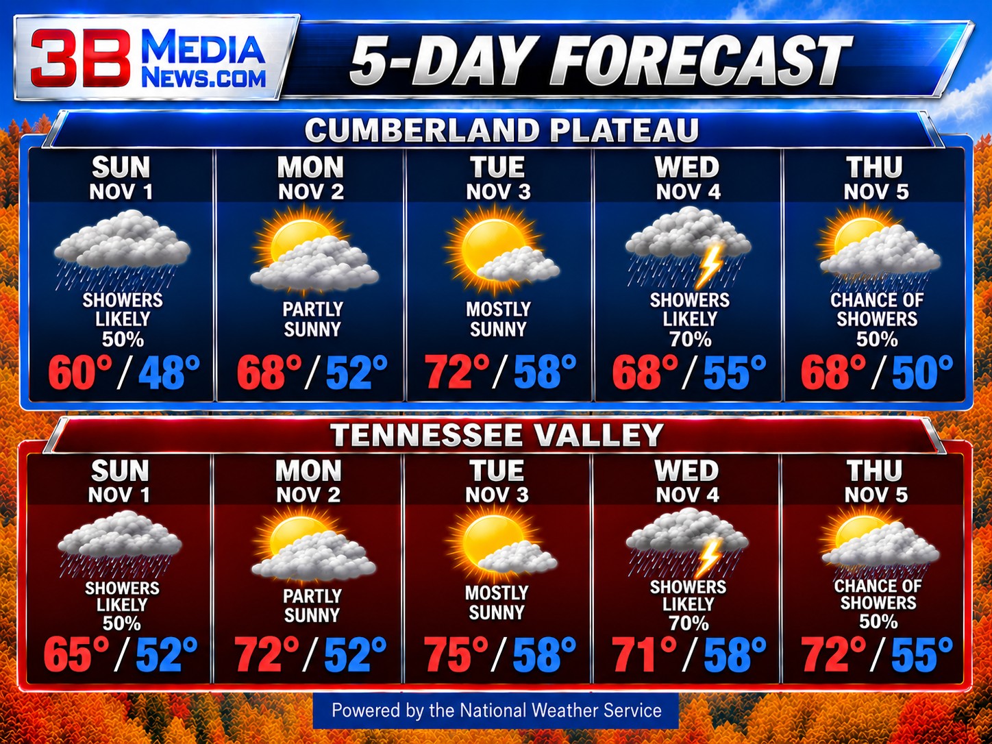
Conditions improve Monday as clouds begin breaking up and some sunshine returns. Highs will reach the upper 60s on the Cumberland Plateau and lower 70s in the Tennessee Valley. Tuesday looks like the nicest day of the week, with mostly sunny skies and temperatures climbing into the lower 70s on the plateau and middle 70s in the valley.
Another round of unsettled weather arrives Tuesday night, with showers becoming more likely Wednesday. Both regions have a 70 percent chance of rain Wednesday and Wednesday night, with a few thunderstorms also possible. Highs Wednesday will reach the upper 60s on the Cumberland Plateau and lower 70s in the Tennessee Valley. Showers may linger into Thursday, although some afternoon sunshine is possible. Temperatures will remain fairly mild, with highs in the upper 60s to lower 70s.
CLIMATE & ALMANAC
Normal High: 62°
Normal Low: 39°
Record High: 81° — 2016
Record Low: 23° — 1993
Record Rainfall: 1.78 inches — 1967
Sunrise: 6:02 AM
Sunset: 4:44 PM
Daylight: 10 hours, 41 minutes
Daylight is decreasing by about two minutes each day. With the return to Standard Time, sunrise and sunset occur approximately one hour earlier on the clock.
SKY & SEASONS
Moon: Last Quarter, approximately 46% illuminated
Next Full Moon: Tuesday, November 24 at 8:53 AM
Next New Moon: Monday, November 9 at 1:02 AM
Next Season Change: Winter begins Monday, December 21.
Daylight Saving Time: Ends today, Sunday, November 1. Clocks fall back one hour at 2:00 AM. Daylight Saving Time returns Sunday, March 14, 2027.
Forecast information provided by the National Weather Service. Climate information is based on National Weather Service and NOAA records. Astronomical information is based on established astronomical calculations.