
Flash Flood Warning
BULLETIN – EAS ACTIVATION REQUESTED
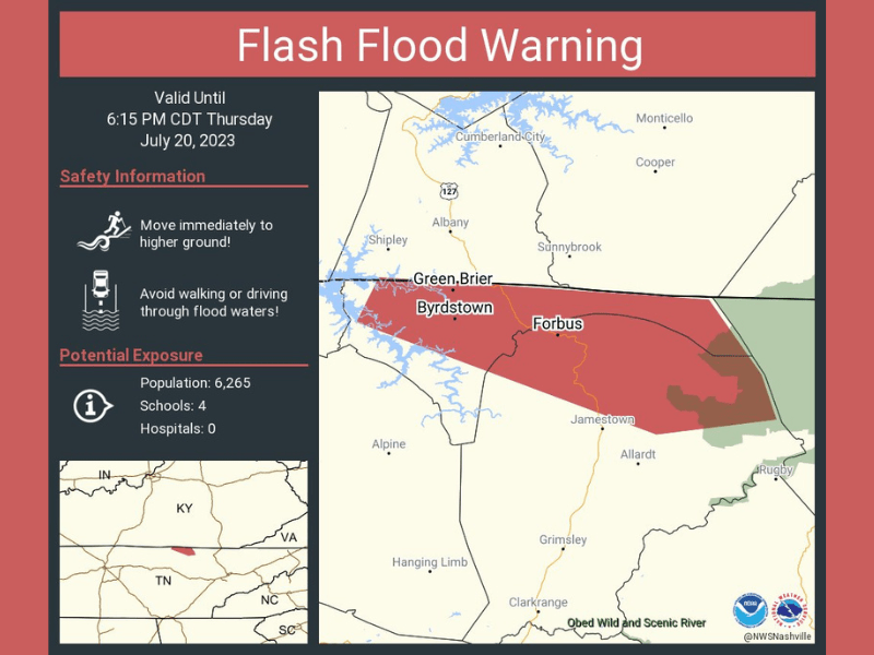
Flash Flood Warning
National Weather Service Nashville TN
316 PM CDT Thu Jul 20 2023
The National Weather Service in Nashville has issued a
- Flash Flood Warning for…
Northern Fentress County in middle Tennessee…
Pickett County in middle Tennessee… -
Until 615 PM CDT.
-
At 316 PM CDT, Doppler radar indicated thunderstorms producing
heavy rain across the warned area. Flash flooding is ongoing or
expected to begin shortly.
HAZARD…Flash flooding caused by thunderstorms.
SOURCE…Radar.
IMPACT…Flash flooding of small creeks and streams, urban
areas, highways, streets and underpasses as well as
other poor drainage and low-lying areas.
- Some locations that will experience flash flooding include…
Jamestown, Byrdstown, Pall Mall and Pickett State Park.
This includes the following streams and drainages…
Wolf River including Byrdstown, Moodyville, Cedar Grove, Parker,
Pall Mall, and Chanute.
PRECAUTIONARY/PREPAREDNESS ACTIONS…
Turn around, don’t drown when encountering flooded roads. Most flood
deaths occur in vehicles.