
NATIONAL WEATHER SERVICE WARNS OF POTENTIAL SEVERE THUNDERSTORMS TODAY AND TONIGHT
MIDDLE TENNESSEE
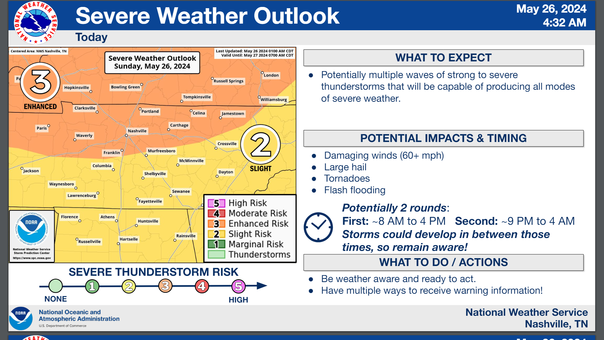
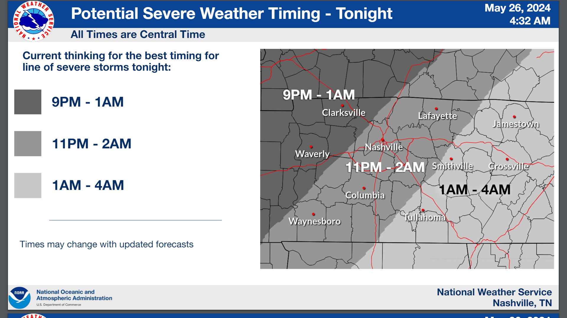
The National Weather Service in Nashville continues to monitor the potential for strong to severe thunderstorms today and tonight. Some activity is possible later this morning as a round of showers and storms pushes in from the west. These storms appear to primarily stay along and north of I-40, but it’s possible they could sink further south. There is still a question of if storms will develop this afternoon or not. The severe threat will significantly increase this afternoon, so any storms that do develop could turn severe fast. Outside of that, the main line of storms could move in from the west tonight as early as 9 PM with the primary threat being damaging winds.
Here is what we know:
What: Strong to severe thunderstorms
Main concerns: Damaging winds, large hail, tornadoes, and flash flooding
When: 2 rounds: mid-morning into the afternoon, then tonight into the overnight hours
Where: All of Middle Tennessee
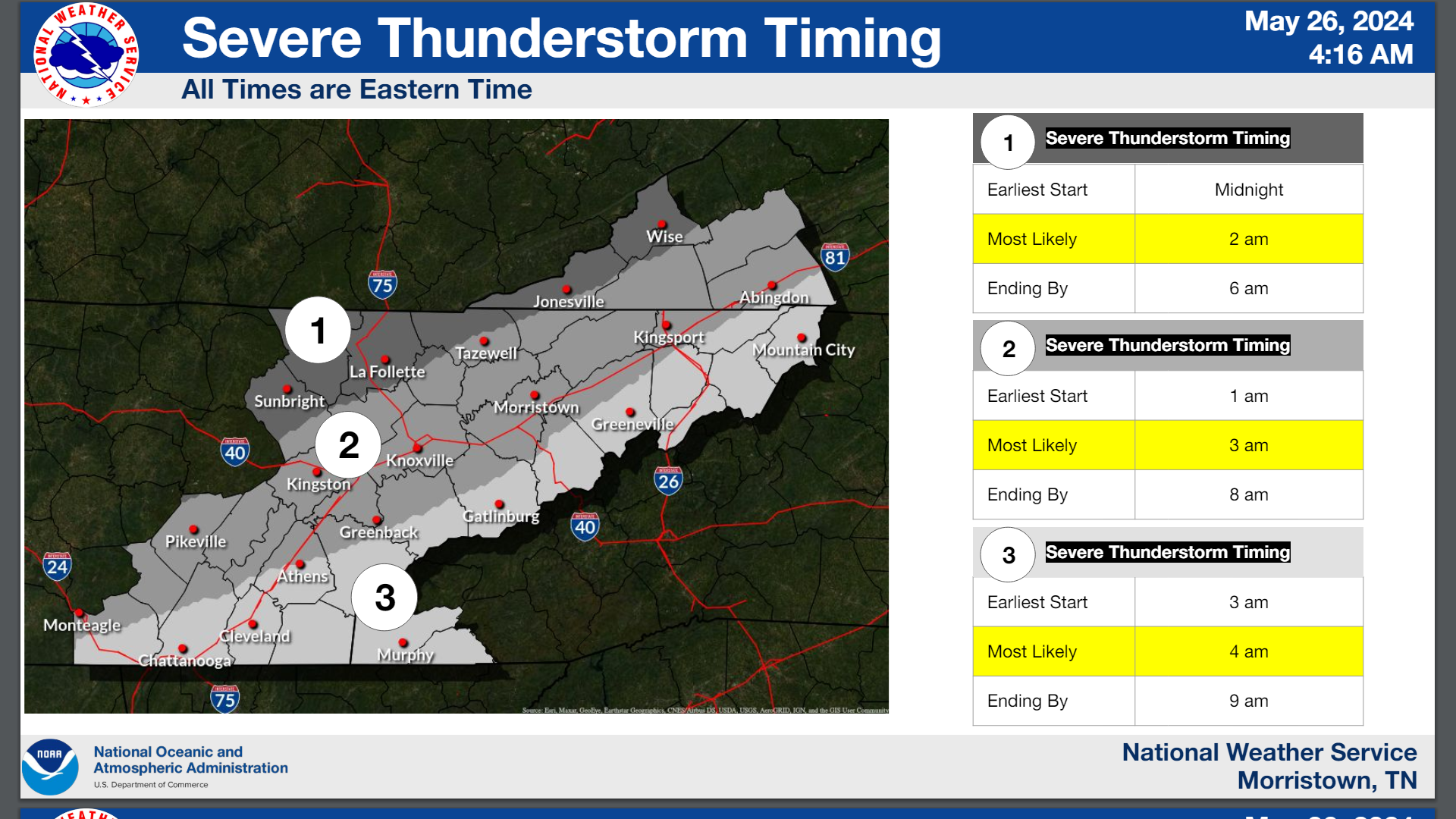
EAST TENNESSEE
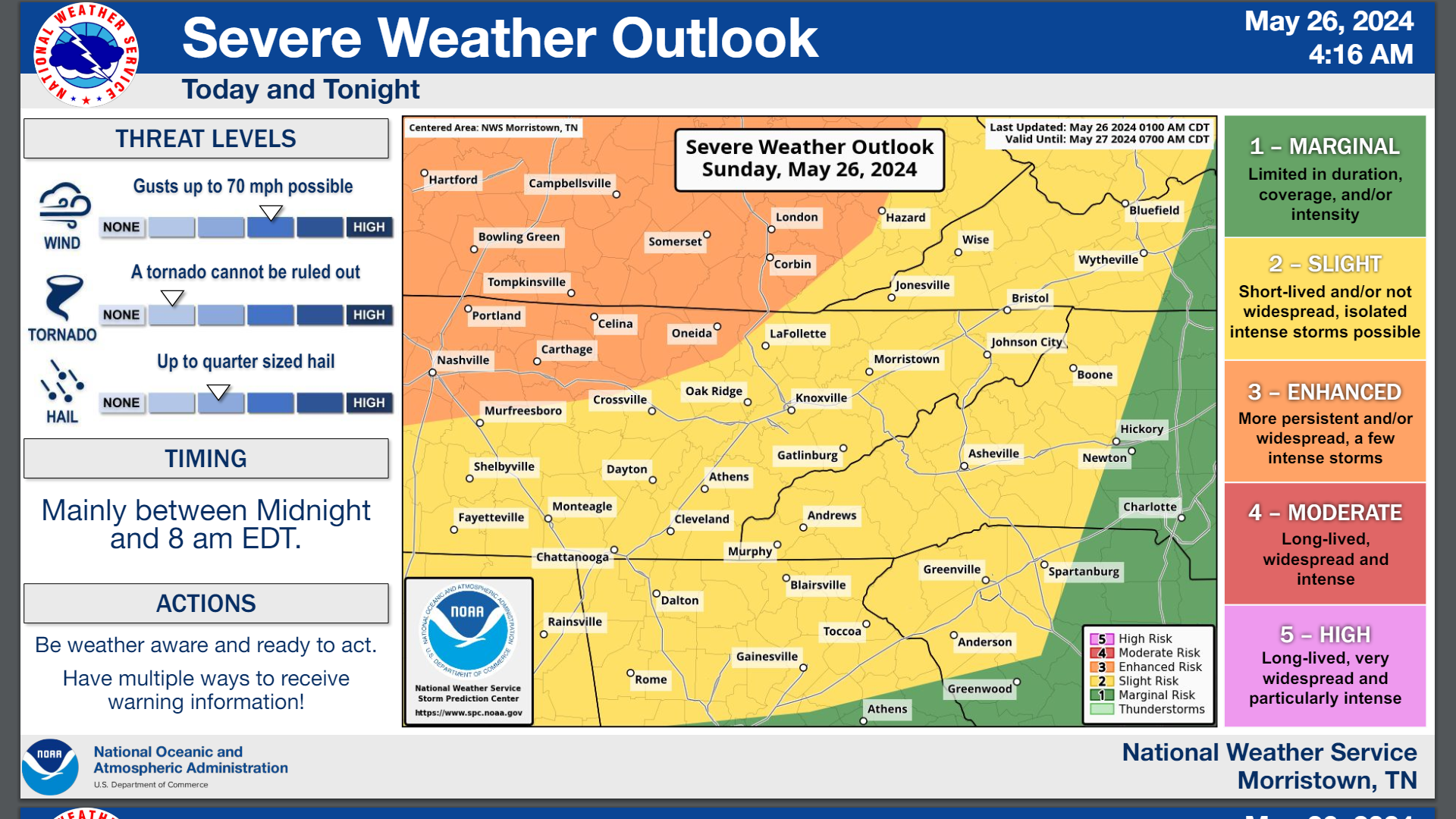
The National Weather Service in Morristown says a line of thunderstorms will move in from the northwest out of Kentucky overnight tonight into Monday morning. This line will likely produce widespread gusty winds, hail, and a brief tornado cannot be ruled out.
FORECAST CHANGES
Confidence is increasing on the timing of the line of thunderstorms overnight tonight.
KEY MESSAGES
Line of thunderstorms capable of damaging winds, hail, and possibly a tornado
Where: Areawide
When: Overnight tonight into Monday morning
FLOODING
Where: Areawide, but highest risk is north of Interstate 40 where multiple rounds of storms are more likely
When: Overnight tonight into Monday morning
IMPACTS
Trees downed from high winds could result in power outages.
Due to recent rainfalls, flood prone locations could become flooded if impacted by repeated rounds of storms.
FORECAST CONFIDENCE
High confidence in the line of thunderstorms moving through overnight bringing widespread strong winds. Medium confidence on thunderstorms this afternoon, mainly north of Interstate 40.
Weather information is provided by the National Weather Service in Nashville and Morristown. Hear the latest forecast on 105.7 The Hog, 94.1 The Vibe (1410 AM), Spirit 101.9, 98.9 The Wolf, and 93.3 The Ranch (580 AM). Get connected with Weathercaster Johnny Caudle on social media. Follow him on Facebook, X, Instagram, and Threads. Click here to send him an email.