
SUNNY AND WARM ELECTION DAY BEFORE HEAVY RAIN ARRIVES WEDNESDAY
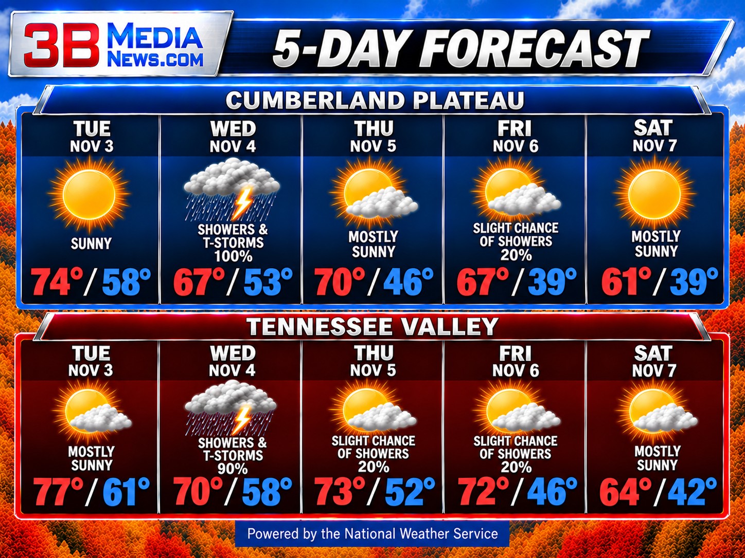
Wednesday looks like the wettest day of the week. Widespread showers and occasional thunderstorms are expected, with rain chances reaching 100 percent on the Cumberland Plateau and 90 percent in the Tennessee Valley. Highs will be cooler, reaching the upper 60s on the plateau and around 70 in the valley. South winds could gust as high as 30 miles per hour on the plateau. Rain begins tapering off Wednesday evening, although showers may continue longer in the Tennessee Valley.
Conditions improve Thursday as clouds gradually break and some sunshine returns. Areas of morning fog are possible on the Cumberland Plateau, with highs near 70, while the Tennessee Valley reaches the lower 70s. A few isolated showers remain possible Thursday and Friday, but most areas should see a return to drier weather.
Cooler air settles across the region Friday night and Saturday. Saturday will be mostly sunny, with highs in the lower 60s on the Cumberland Plateau and middle 60s in the Tennessee Valley. Overnight temperatures will fall into the 30s and 40s, bringing a noticeably cooler feel to the weekend.
CLIMATE & ALMANAC
Normal High: 61°
Normal Low: 39°
Record High: 79° — 2003
Record Low: 8° — 1954
Record Rainfall: 0.79 inches — 2004
Sunrise: 6:04 AM
Sunset: 4:42 PM
Daylight: 10 hours, 38 minutes
Daylight is decreasing by approximately two minutes each day.
SKY & SEASONS
Moon: Waning Crescent, approximately 35% illuminated during the day
Next Full Moon: Tuesday, November 24 at 8:53 AM
Next New Moon: Monday, November 9 at 1:02 AM
Next Season Change: Winter begins Monday, December 21.
Daylight Saving Time: Returns Sunday, March 14, 2027. Clocks move forward one hour at 2:00 AM.
Forecast information provided by the National Weather Service. Climate information is based on National Weather Service and NOAA records. Astronomical information is based on established astronomical calculations.