
TROPICAL STORM WARNING IN EFFECT AS STORM HEADS TOWARD GULF COAST
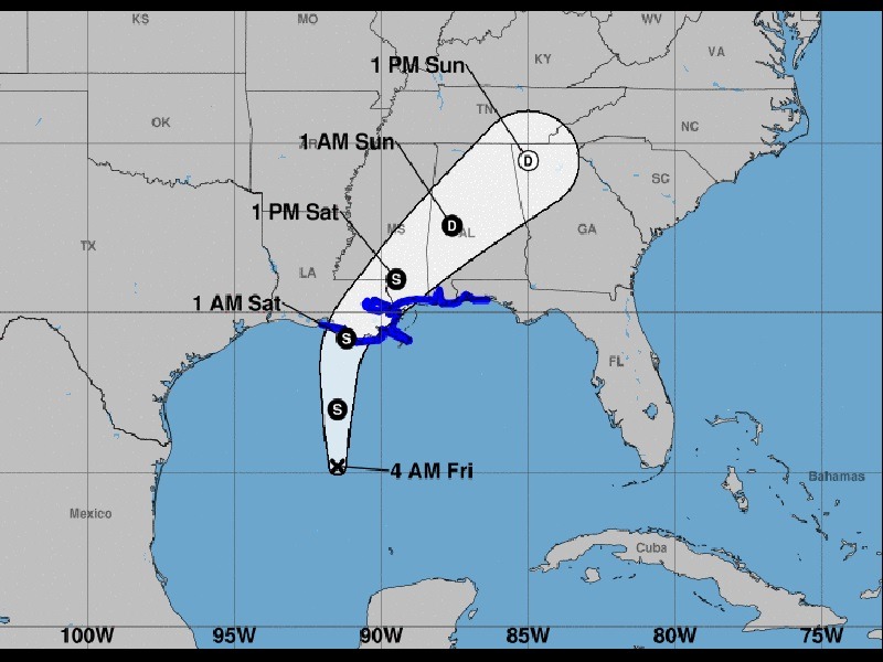
Louisiana Governor John Bel Edwards declared a state of emergency yesterday ahead of a potential tropical storm that will likely hit his state and parts of Mississippi and Alabama later today.
Should it reach tropical storm status later today, it will be named Claudette.
The storm was about 450 miles south of Louisiana as of last night, with maximum sustained winds of 30 mph.
A tropical storm warning is in effect, ranging from Intracoastal City, Louisiana, to the Alabama-Florida border.
A flash flood watch will also be in effect starting this afternoon. Rainfall totals of 4-10 inches are expected in New Orleans, with higher amounts in isolated areas.
“The system is expected to produce heavy rainfall and considerable flash, urban, and small stream flooding beginning Friday and continuing through the weekend along the central Gulf coast and spreading northeastward into the Southern Appalachians,” the National Hurricane Center forecast.
Tornadoes are also possible throughout Louisiana and neighboring states today, according to the National Weather Service.
Coastal flooding is possible as well in parts of Louisiana, Mississippi, and Alabama, with up to 2-3 feet of inundation.