HEAVY RAIN AND FLASH FLOOD RISK CONTINUES THROUGH TONIGHT
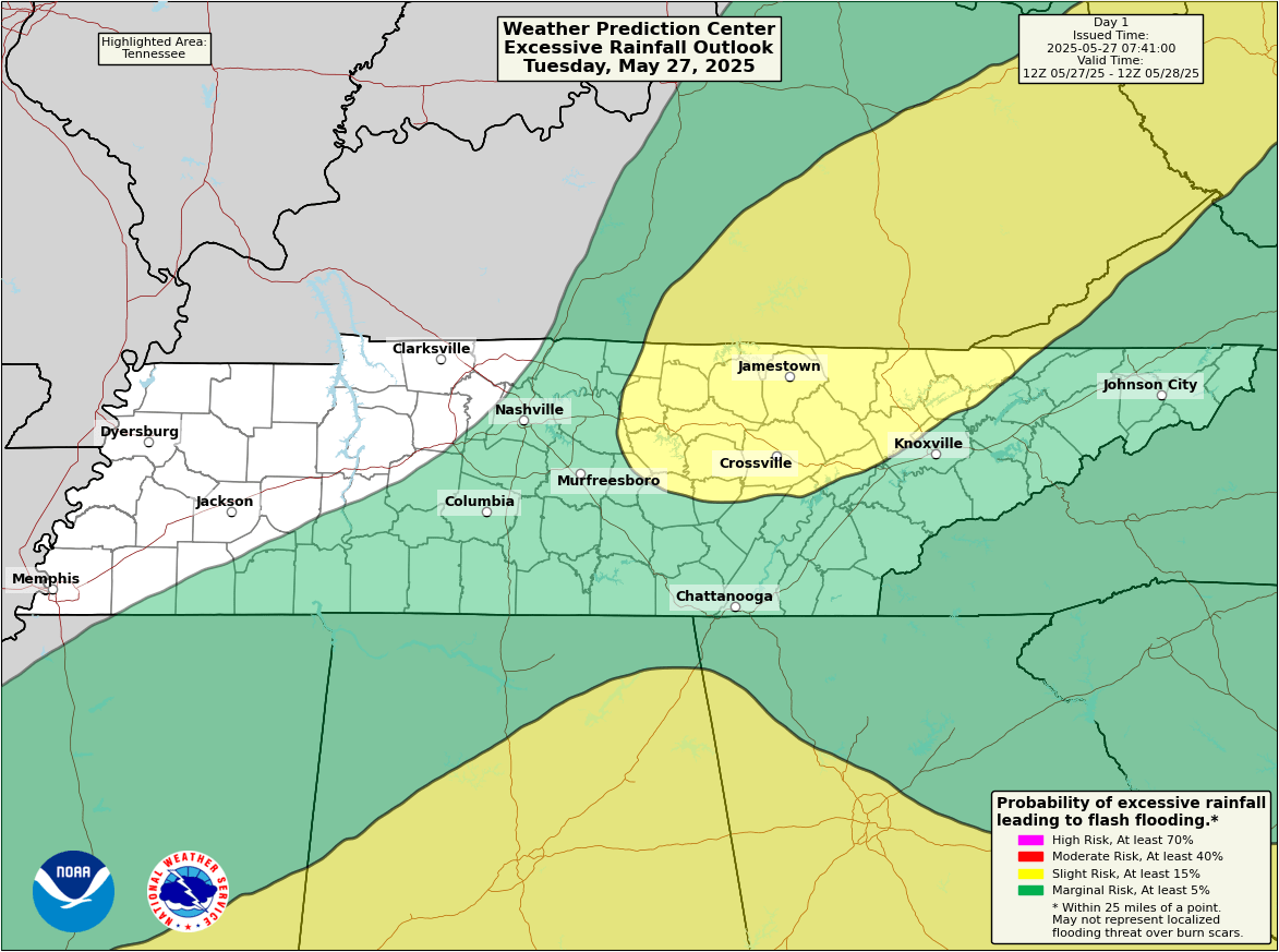
The Weather Prediction Center has placed parts of Middle and East Tennessee under a Slight Risk (Level 2 of 4) for excessive rainfall today, with a Marginal Risk (Level 1) covering much of the surrounding region. This means scattered flash flooding is possible, especially in low-lying or urban areas where heavy rain may fall repeatedly over the same locations.
Multiple rounds of showers and thunderstorms are expected through late tonight. Although widespread severe weather is not forecast, isolated flooding could become an issue where storms linger or regenerate. Areas like Crossville and Jamestown are among those under the slight risk zone, while cities including Chattanooga, Columbia, and Murfreesboro are under a marginal risk.
Forecasters also caution that a cluster of strong to possibly severe thunderstorms could move in from Alabama tonight, impacting the southern portion of the area. These storms could bring gusty winds, locally heavy rainfall, and enhance the risk of flash flooding.
Residents are encouraged to monitor local forecasts, especially in flood-prone areas, and remain weather-aware throughout the evening and overnight hours.