
ROANE COUNTY PREPARES FOR WEEKEND WEATHER
Posted by Rockwood Electric Utility:
Rockwood Electric is monitoring the winter weather and is communicating with its valley partners such as Roane County Road Department, TVA, TVPPA, and TMEPA. Should you experience a power outage over the next several days, Rockwood Electric will move as quickly as possible to assess the damage and dispatch crews as safely as possible. Safety of our employees and the public is a priority.
Posted by the Rockwood Police Department:
958 AM UPDATE- A ICE STORM WARNING HAS BEEN ISSUED
This is one of several updates we’ll be sharing for the Rockwood and Roane County area. If you need to run errands or heading back and forth from work today, conditions look good. No precipitation is expected today or tonight.
The National Weather Service continues to keep our area under a Winter Storm Watch. At some point today, this will likely be upgraded to a Warning or Advisory. Current NWS forecasts and model guidance show snow and freezing rain moving in Saturday morning. At this time, the primary concern remains freezing rain and accumulating ice.
Models indicate temperatures may warm slightly on Sunday, changing the precipitation over to all rain. As the system exits, there is a chance it could briefly transition back to snow or freezing rain.
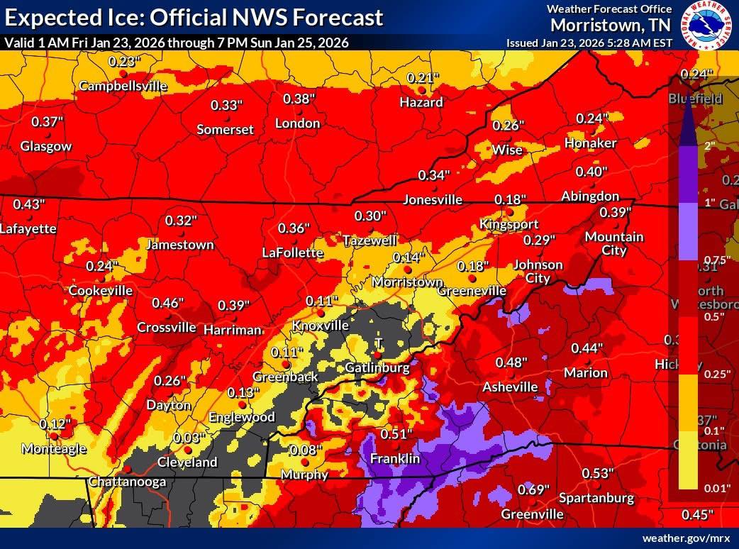
Maps are provided by the National Weather Service Office in Morristown.
We will continue to share updates on weather alerts, road conditions, and any emergency information as needed. Stay safe and stay informed.