
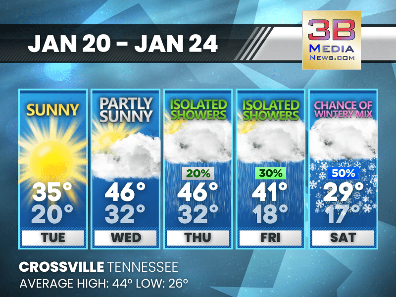
WINTRY WEEKEND THREAT BUILDS AFTER A COLD, QUIET START TO THE WEEK
A stretch of sunny to partly sunny days gives way to late-week showers and a Saturday risk for a wintry mix as temperatures drop. Tuesday: Sunny, with a high near 35. Calm wind. Tuesday Night: M ...
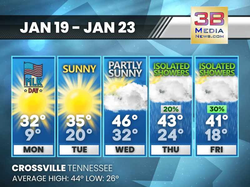
COLD, QUIET WEEK AHEAD WITH CLOUDS AND LATE-WEEK SHOWERS
The pattern stays chilly through midweek before clouds increase and isolated showers move in Thursday and Friday. M.L.King Day: Sunny, with a high near 32. West northwest wind 5 to 10 mph, with gus ...
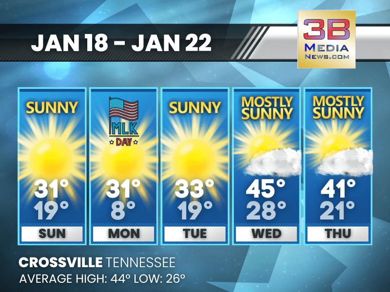
COLD, DRY START WITH A MIDWEEK WARMUP
A stretch of sunny, chilly days leads into a milder pattern by midweek. Sunday: Sunny, with a high near 31. Calm wind becoming west around 5 mph in the morning. Sunday Night: Mostly clear, with ...
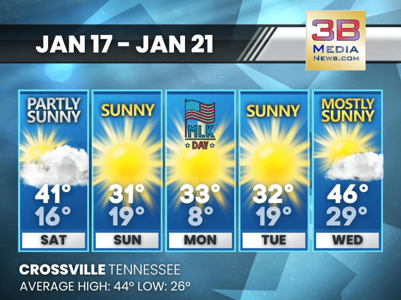
COLD, QUIET STRETCH WITH PLENTY OF SUNSHINE AHEAD
A dry pattern settles in with several sunny days and the coldest air arriving Monday morning. Today: Partly sunny, with a high near 41. West southwest wind 5 to 10 mph, with gusts as high as 20 mph ...
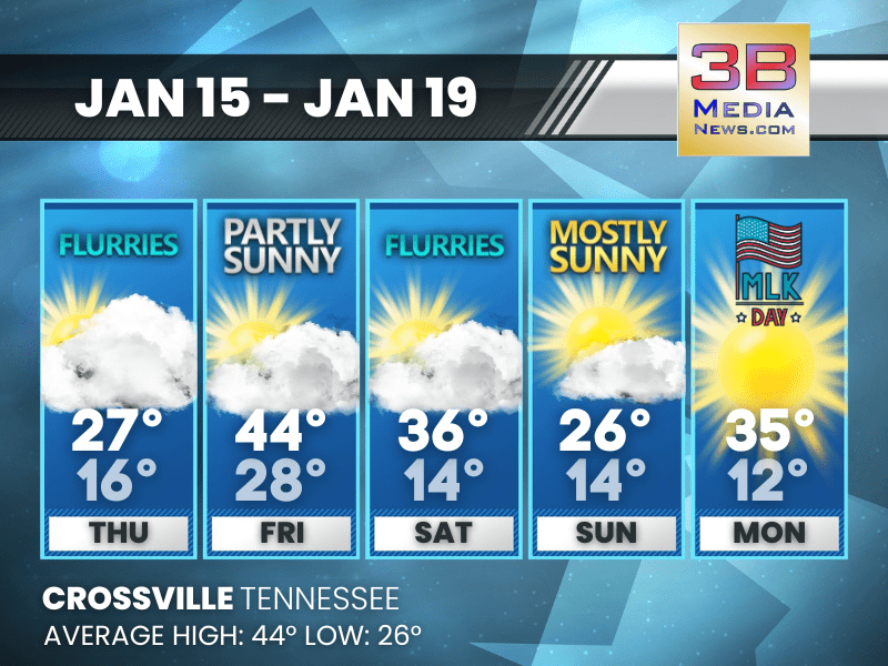
COLD WEEKEND AHEAD WITH LIGHT PRECIPITATION AND BIG TEMPERATURE DROP
A quick hit of showers Friday and scattered flurries Saturday leads into a much colder stretch with brighter skies returning Sunday through Tuesday. Friday: A chance of sprinkles before 4pm, then a ...
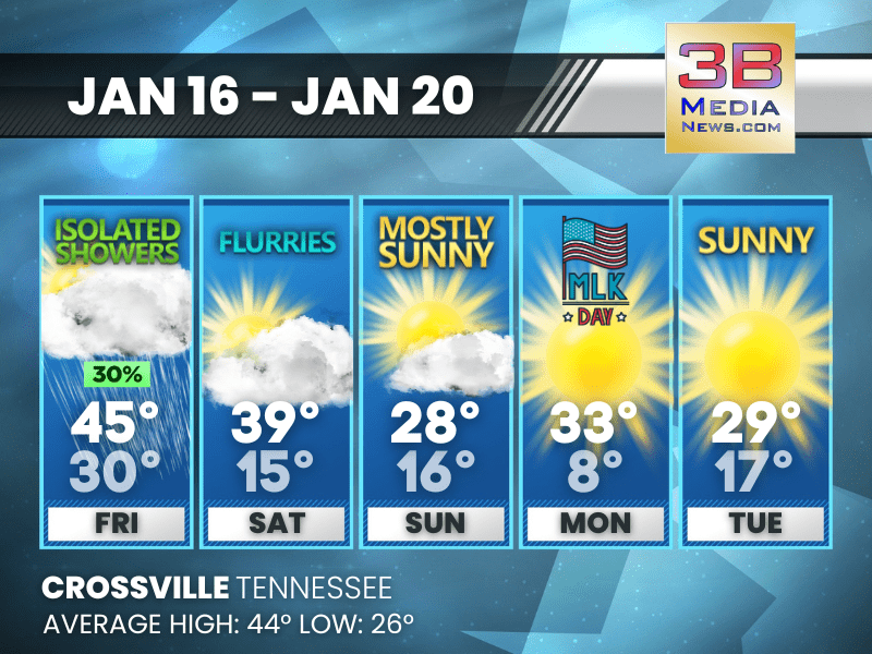
ARCTIC AIR HOLDS FIRM WITH FLURRIES AND FRIGID NIGHTS
Crossville faces off-and-on flurries and a sharp weekend cooldown before a brighter but still chilly MLK Day. Thursday: A chance of flurries before 7am. Mostly cloudy, then gradually becoming sunny ...
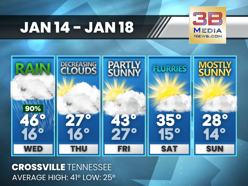
MIDWEEK RAIN GIVES WAY TO A COLDER, BRIGHTER FINISH
Rain clears out Wednesday, followed by a steady cool-down and increasing sunshine through the weekend. Today: Rain before 5pm, then a chance of rain and snow. High near 46. Southwest wind 5 to 10 m ...
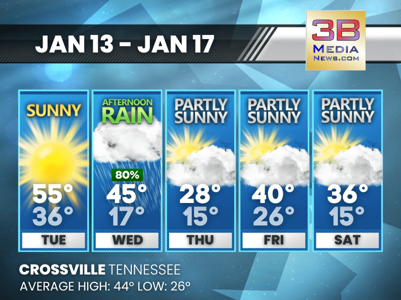
ARCTIC BLAST RETURNS AFTER MIDWEEK RAIN
A warm and sunny Tuesday gives way to afternoon rain Wednesday before temperatures plunge into the teens with a stretch of cold, partly sunny days. Tuesday: Sunny, with a high near 55. Southwest wi ...

SUNNY OPEN TO THE WEEK BEFORE A MIDWEEK RAIN-TO-SNOW DROP
The pattern turns unsettled after Tuesday, shifting from afternoon rain Wednesday to morning snow Thursday. Monday: Sunny, with a high near 45. Calm wind becoming west around 5 mph. Monday Night ...
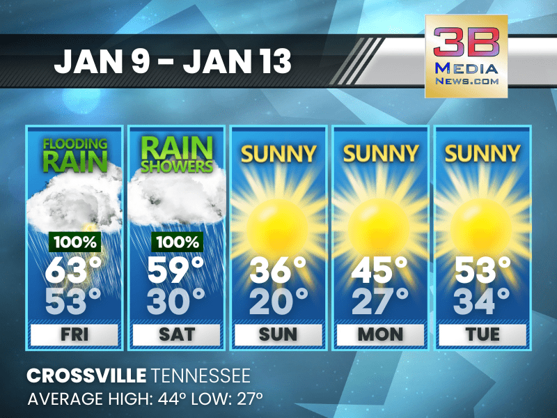
FLOODING RAIN FRIDAY, THEN A SHARP TURN TO COLD SUNSHINE
Rainfall ends Saturday before a much colder and brighter stretch moves in through early next week. Friday: Showers and thunderstorms before 3pm, then a chance of showers. High near 63. South wind 1 ...

HEAVY RAIN AND FLOODING THREATEN TENNESSEE THROUGH SATURDAY
A strong, slow-moving storm system will move across Tennessee beginning tonight and lasting through Saturday, bringing periods of heavy rain, flooding, and a low but notable risk for strong thundersto ...
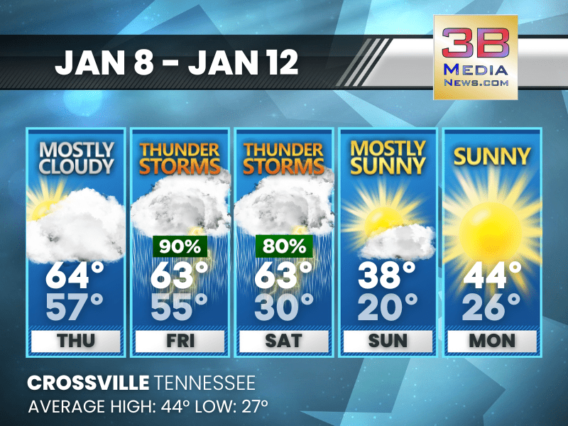
STORMS LATE WEEK FOLLOWED BY A SHARP WEEKEND COOL-DOWN
Crossville faces thunderstorms Friday and Saturday before temperatures crash into the 30s and 20s by Sunday. Thursday: Mostly cloudy, with a high near 64. South wind 5 to 10 mph, with gusts as high ...