
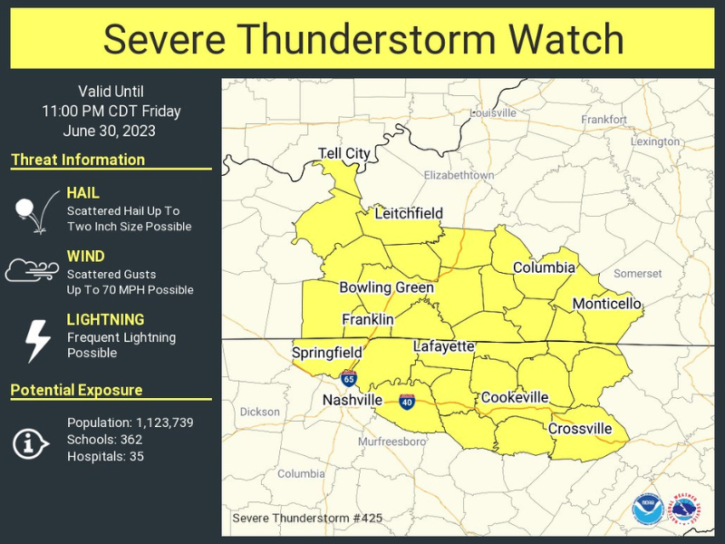
SEVERE THUNDERSTORM WATCH
A Severe Thunderstorm Watch has been issued for parts of Kentucky and Tennessee until 11:00 PM CDT. Scattered hail up to two inch size possible. Scattered wind gusts up to 70 mph possible. Frequent li ...

HEAT ADVISORY ISSUED
New event. Heat Advisory from 7/1/2023 11:00 AM to 7:00 PM CDT for Clay County, TN. Click here for more information.
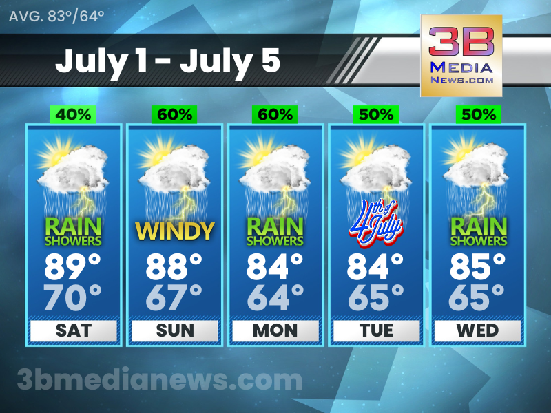
SATURDAY’S 5 DAY FORECAST
Saturday: A 40 percent chance of showers and thunderstorms, mainly after noon. Mostly sunny, with a high near 89. West wind 5 to 10 mph. Saturday Night: A 30 percent chance of showers and thunderstor ...
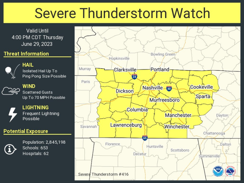
SEVERE THUNDERSTORM WATCH
New event. Severe Thunderstorm Watch from 6/29/2023 10:59 AM to 4:00 PM CDT for Overton County, TN, White County, TN, Van Buren County, TN, Clay County, TN, Putnam County, TN. Click here for more info ...
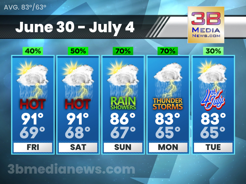
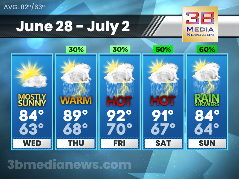
FRIDAY’S 5 DAY FORECAST
Excessive Heat Warning for Overton County, Pickett County, White County, Van Buren County, Clay County, and Putnam County from 11:00 AM to 8:00 PM CDT Friday. Dangerously hot conditions with heat inde ...
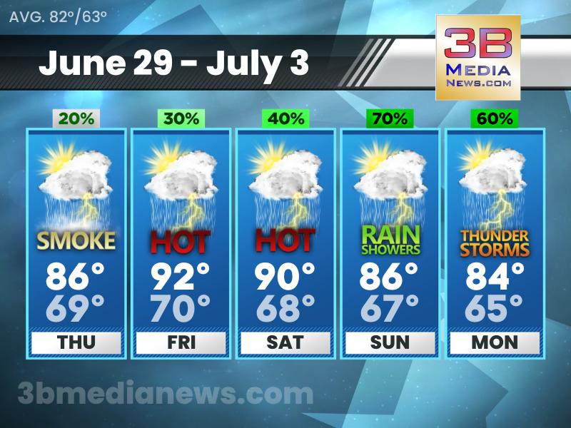
THURSDAY’S 5 DAY FORECAST
Thursday: A 20 percent chance of showers and thunderstorms after 11am. Widespread haze before 1pm. Mostly sunny, with a high near 86. Southeast wind 5 to 10 mph becoming south southwest in the morning ...

SMOKE FROM CANADIAN WILDFIRES TO CAUSE HAZY SKIES
A plume of smoke left over from Canadian wildfire activity will work southward across the area today, leading to hazy skies, reduced visibility in some locations, and poor air quality. To get the air ...

EXCESSIVE HEAT WARNING
The National Weather Service has issued an Excessive Heat Warning for Overton County, Pickett County, White County, Van Buren County, Clay County, and Putnam County from 11:00 AM to 8:00 PM CDT Friday ...
WEDNESDAY’S 5 DAY FORECAST
Wednesday: Mostly sunny, with a high near 84. Calm wind becoming northwest around 5 mph in the morning. Wednesday Night: Mostly clear, with a low around 63. North northwest wind around 5 mph becoming ...
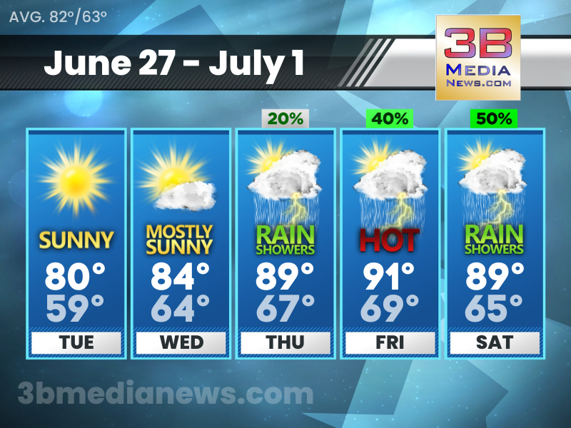
TUESDAY’S 5 DAY FORECAST
Tuesday: Sunny, with a high near 80. West northwest wind 5 to 10 mph, with gusts as high as 20 mph. Tuesday Night: Mostly clear, with a low around 59. Northwest wind 5 to 10 mph. Wednesday: Mostly s ...

SEVERE THUNDERSTORM WATCH
A Severe Thunderstorm Watch has been issued for parts of Tennessee until 6:00 PM CDT. Isolated hail up to ping pong size possible. Scattered wind gusts up to 70 mph possible.
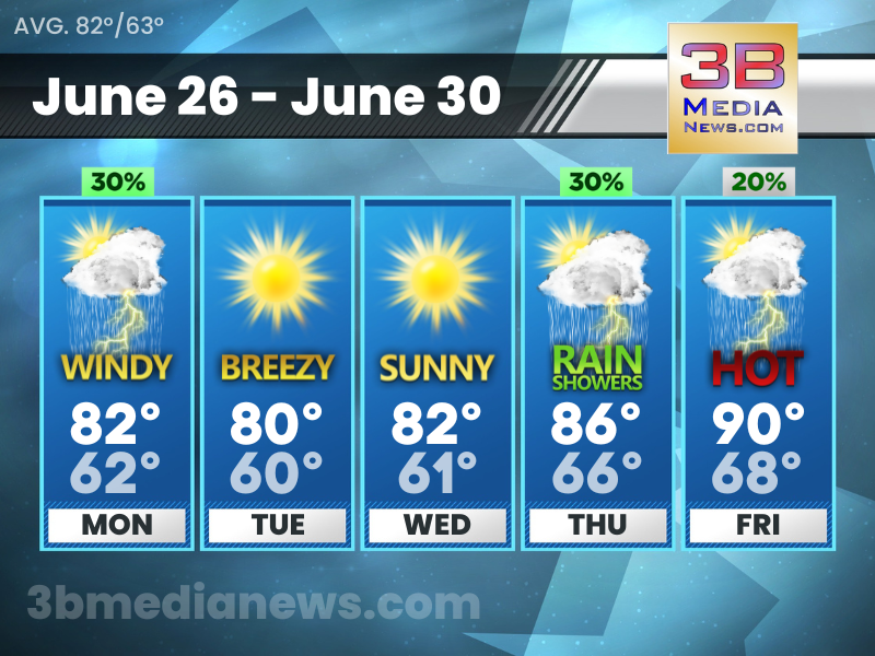
MONDAY’S 5 DAY FORECAST
Monday's Hazardous Weather Outlook for East Tennessee: A cold front will move through Monday afternoon and evening. A few strong storms may accompany this front. These storms could produce some margin ...