
RECORD-BREAKING HEAT WAVE TO TOAST THE REGION BEFORE LATE-WEEK THUNDERSTORMS
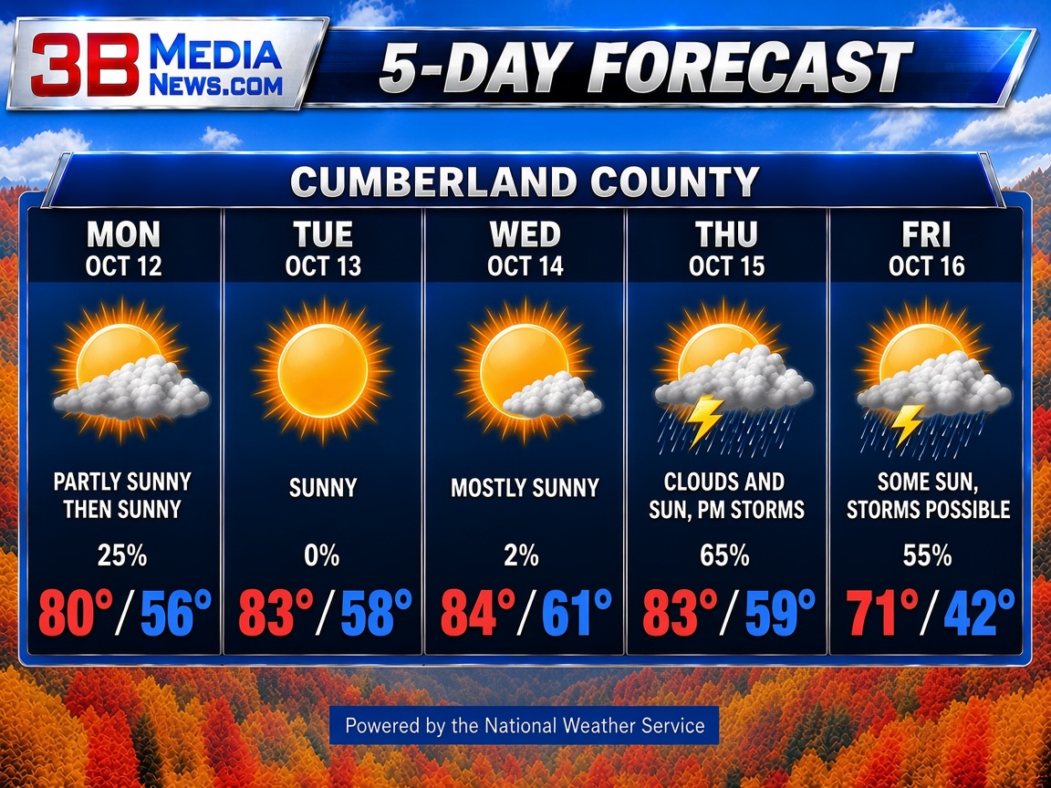
A multi-day stretch of unseasonably warm weather is set to break long-standing temperature records across the area this week, bringing summer-like heat and humidity before a cold front brings cooler weather and rain by Friday.
Early to Mid-Week: Record-Setting Heat Wave
The week begins on Monday, October 12, with lingering cloud cover giving way to partial sunshine. High temperatures will approach 80°F—flirting with the daily record high of 81°F established in 1985—while humidity pushes the heat index up to 88°F.
The main story develops over the next two days as high pressure settles over the area:
-
Tuesday, October 13: Abundant sunshine drives temperatures up to 83°F, eclipsing the previous 1975 record high of 82°F.
-
Wednesday, October 14: The heat intensifies further under mostly sunny skies, reaching 84°F and shattering the 1989 record of 81°F. Values will again peak near 88°F.
Thursday: Peak Humidity and Afternoon Storms
The streak of historic temperatures continues into Thursday, October 15, with highs reaching 83°F—easily beating the 2008 record high of 79°F. However, moisture levels will surge significantly throughout the day. Under a mix of sun and clouds, rising humidity will trigger isolated to scattered afternoon thunderstorms, bringing brief heavy rain.
Friday: Cool Front Brings Relief
A cold front pushes through the region on Friday, October 16, putting an end to the record-breaking warm spell. Expect breezy conditions with winds shifting out of the northwest at 10 mph. Skies will feature a mix of clouds and sun alongside localized spot thunderstorms, with daytime highs dropping back closer to seasonal norms at 71°F and overnight lows dipping to a crisp 42°F.
Weather Outlook at a Glance
| Date | Forecast High / Low | Sky Conditions | Key Highlight |
| Mon 10/12 | 80°F / 56°F | Turning Sunny | Approaches 1985 Record (81°F) |
| Tue 10/13 | 83°F / 58°F | Plenty of Sun | Breaks 1975 Record (82°F) |
| Wed 10/14 | 84°F / 61°F | Mostly Sunny | Breaks 1989 Record (81°F) |
| Thu 10/15 | 83°F / 59°F | Sun & Clouds | Breaks 2008 Record (79°F); PM Storms |
| Fri 10/16 | 71°F / 42°F | Breezy, PM Spot Storms | Cooler air arrives behind front |
