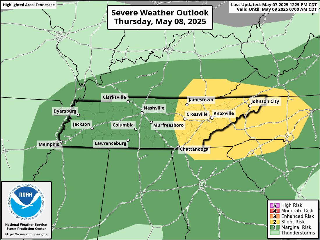
SEVERE STORMS POSSIBLE THURSDAY WITH DAMAGING WINDS AND LARGE HAIL

The National Weather Service is monitoring a developing severe weather threat for Thursday, May 8, across parts of the Tennessee Valley and Southern Appalachians. A Slight Risk (Level 2 out of 5) for severe thunderstorms has been issued for much of East Tennessee and Western North Carolina, including cities such as Knoxville, Crossville, Asheville, and Charlotte. Storms are expected to develop during the late afternoon and continue into the evening, with the primary window for severe weather occurring between 4 PM and 10 PM.
The main concerns with this system are damaging straight-line winds and large hail. Wind gusts could reach up to 65 mph, and hail as large as 1.5 inches in diameter (about the size of ping pong balls) is possible. The probability of either hazard occurring within 25 miles of any given point across the affected region ranges from 15 to 29 percent. While the tornado risk is not zero, it remains low—generally less than 2 percent—across the area.
Residents in the impacted zones are urged to stay weather-aware throughout the day, ensure they have multiple ways to receive warning information, and be ready to act if threatening weather approaches. The forecast will be updated as new information becomes available.