SEVERE WEATHER THREAT LOOMS FOR TENNESSEE FRIDAY NIGHT

A widespread severe weather event is expected across much of Middle and East Tennessee late Friday into early Saturday, with the potential for damaging winds, large hail, flash flooding, and even isolated tornadoes. According to the National Weather Service offices in Nashville and Morristown, an intense line of thunderstorms will move through the region between 8 PM and 2 AM Central Time. Ahead of this line, a few discrete cells could form, carrying a risk of tornadoes—especially north of I-40 and west of I-65.
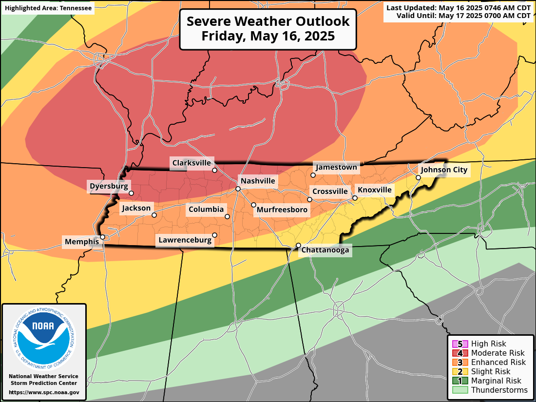
The Storm Prediction Center has issued an Enhanced Risk (Level 3 of 5) for severe weather across the Cumberland Plateau and Knoxville areas, with a Moderate Risk (Level 4) just to the northwest. Hazards include damaging winds of 65+ mph, hail up to 3 inches in diameter, and a medium chance of tornadoes, particularly in Middle Tennessee. The Weather Prediction Center has also highlighted the region for a Slight Risk of excessive rainfall, which may lead to localized flash flooding, especially in areas that receive repeated rounds of storms.
The most likely timing for severe storms in Crossville is between 9 PM and 11 PM Central Time, and for Knoxville between 10 PM and midnight Eastern Time, with storms clearing out by early Saturday morning. Residents are encouraged to stay alert, review safety plans, and have multiple ways to receive warnings—such as weather radios, mobile alerts, or trusted local stations.
Hear weather updates throughout the day and night on 105.7 The Hog, Spirit 101.9, 94.1 The Vibe (1410 AM), 98.9 The Wolf, and 93.3 The Ranch (580 AM). This information is based on data provided by the National Weather Service in Nashville and Morristown, the Storm Prediction Center, and the Weather Prediction Center.