SEVERE WEATHER UPDATE

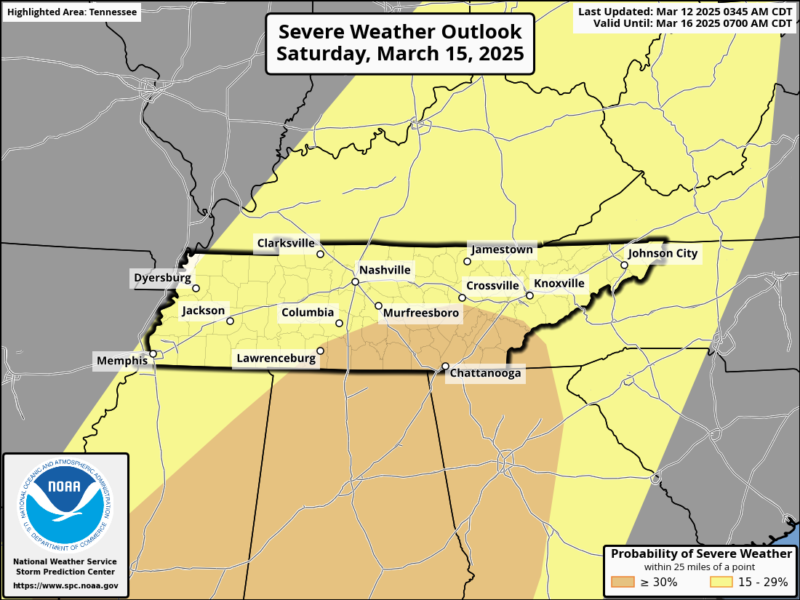
Severe weather remains a concern for late Saturday, though some uncertainty still exists regarding the exact details. However, the latest trends indicate an increasing potential for a significant severe weather event, particularly across the Cumberland Plateau and into southeast Tennessee. Damaging winds appear to be the primary threat, but large hail and tornadoes are also possible. On Friday, March 14, a more widespread severe weather threat is expected across western and central Tennessee, with an Enhanced Risk (Level 3 of 5) extending from Memphis to Nashville and up to Clarksville. Areas further east, including Crossville and Knoxville, will be under a Marginal Risk (Level 1 of 5), meaning isolated severe storms are possible. By Saturday, March 15, the severe weather risk shifts eastward, covering much of Tennessee with a 15-29% probability of severe storms within 25 miles of a given location. The greatest potential is in southern Tennessee, including areas near Chattanooga and Lawrenceburg, where the risk exceeds 30%.
In addition to severe storms, the risk of flash flooding continues to increase, particularly west of Interstate 75, as multiple rounds of storms move through the region. Stay tuned for updates as confidence in the forecast improves. For the latest weather information, tune in to 105.7 The Hog, Spirit 101.9, 94.1 The Vibe (1410 AM), 98.9 The Wolf, and 93.3 The Ranch (580 AM).
Sources: National Weather Service, Storm Prediction Center.