
TROPICAL STORM ARTHUR MAKES CLOSE PASS WITH OUTER BANKS OF NORTH CAROLINA
The first named storm of the 2020 Atlantic hurricane season lashed eastern North Carolina with rain and gusty winds this morning, as the tropical storm made a close pass at the state’s Outer Banks.
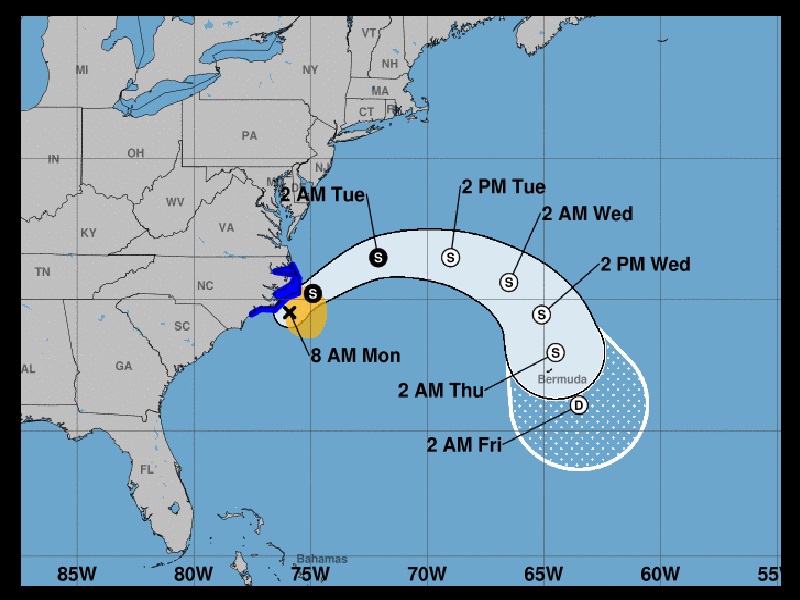
The U.S. National Hurricane Center (NHC) said as of 8 a.m. eastern today, Tropical Storm Arthur is located about 50 miles east-southeast of Morehead City, moving north-northeast at 15 mph with maximum sustained winds of 45 mph.
Tropical storm warnings have been posted from Surf City to Duck, North Carolina, including the Pamlico and Albemarle Sounds.
Eastern North Carolina and the Outer Banks were seeing increasing wind gusts and rain as of this morning as the center of Arthur passed offshore.
Arthur remains a minimal tropical storm, with maximum sustained winds of 45 mph. The NHC said tropical-storm-force winds extend outward up to 90 miles, mainly to the east of the center of Arthur.
Gusts to 50 mph are possible along the Outer Banks through today with between one to three inches of rain. Isolated maximum amounts of up to five inches of rain are possible in coastal areas.
Forecasters from the NHC said very slight strengthening is possible over the next 24 hours. Arthur is then forecast to turn away from the east coast of the U.S. tonight into tomorrow.