

SEVERE THUNDERSTORM WATCH ISSUED UNTIL 8:00 P.M.
A Severe Thunderstorm Watch is in effect until 8:00 PM CDT this evening for portions of Middle Tennessee, including Cumberland, Pickett, and Fentress counties. The
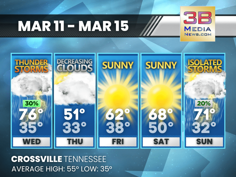
STORMS MIDWEEK, SUNSHINE RETURNS BEFORE A LATE WEEKEND SHOWER CHANCE
Thunderstorms give way to clearing skies and a sunny stretch before a few isolated storms return late in the weekend. Wednesday: A 30 percent chance of
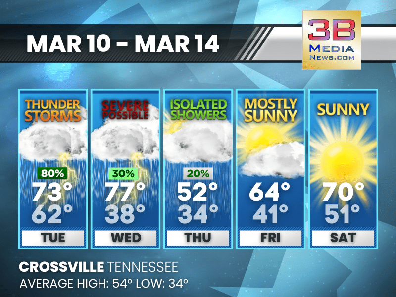
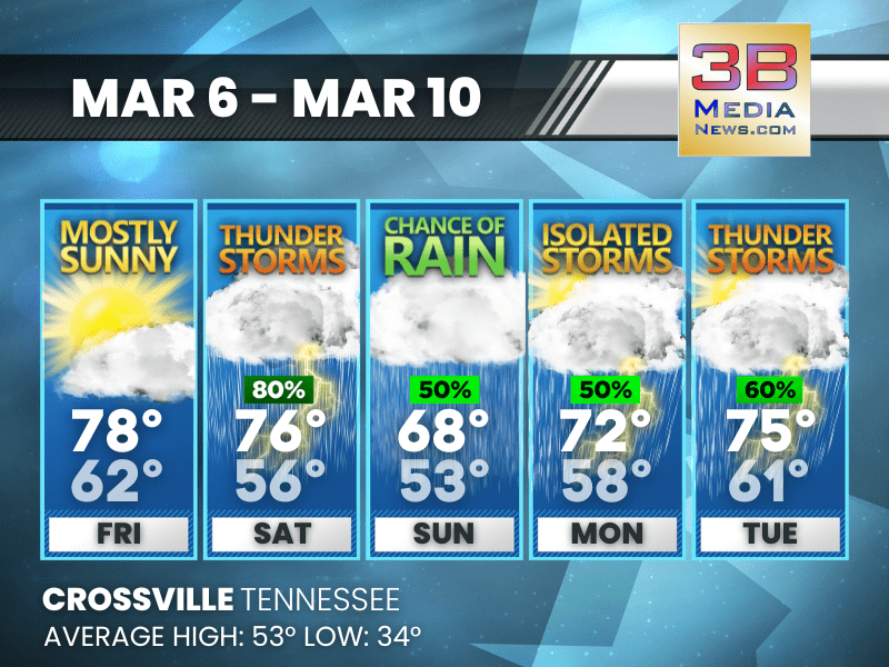
STORMS AND SEVERE THREAT MIDWEEK BEFORE A SUNNY REBOUND
Thunderstorms could turn severe midweek before cooler air moves in, followed by improving skies and sunshine heading into the weekend. Tuesday: Showers and thunderstorms, mainly before
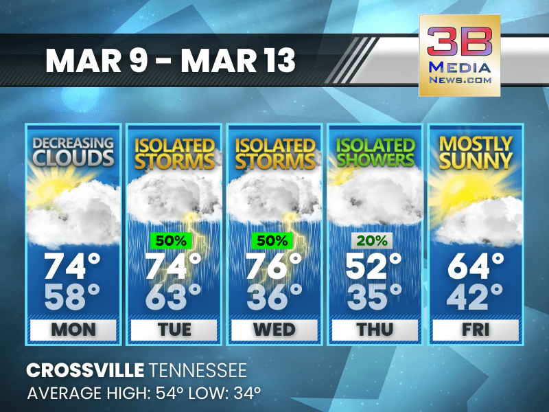
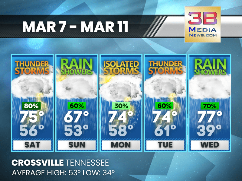
WARM STRETCH FOLLOWED BY MIDWEEK STORMS AND A COOLER TURN
Unseasonably warm temperatures early in the period give way to scattered storms before cooler air arrives late week with improving sunshine. Monday: Partly sunny, then gradually
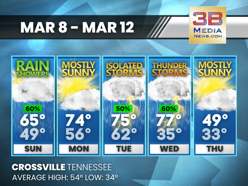
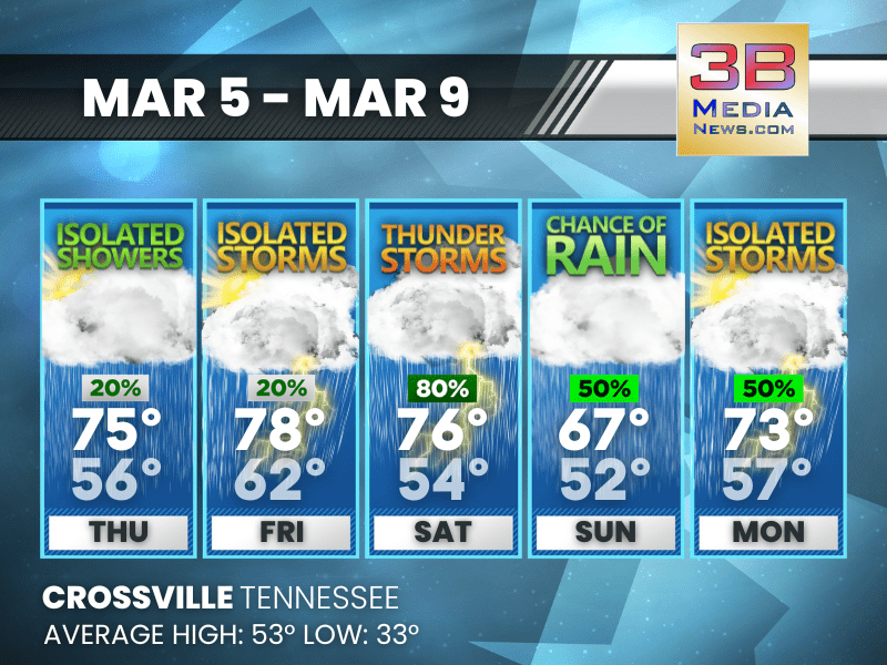
RAIN AND STORMS MIDWEEK BEFORE A SHARP COOL-DOWN
Rain and thunderstorms increase through midweek, followed by a noticeable drop in temperatures by Thursday. Sunday: Showers likely before 4pm, then a slight chance of showers
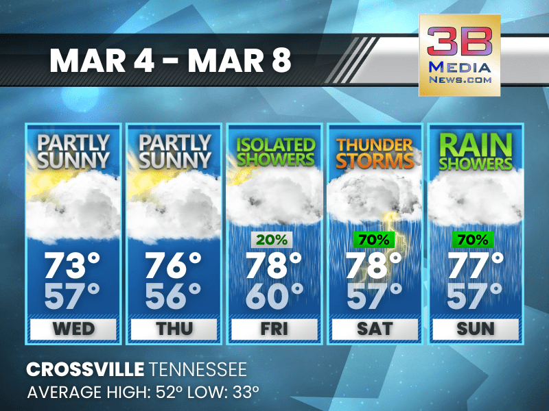
STORMY STRETCH AHEAD WITH ROUNDS OF RAIN THROUGH MIDWEEK
Multiple rounds of rain and thunderstorms are expected from the weekend into midweek, with mild temperatures continuing throughout the period. Today: Showers and thunderstorms likely, then
WARM START GIVES WAY TO STORMY STRETCH INTO EARLY WEEK
A warm and mostly sunny Friday is followed by several days of showers and thunderstorms through early next week. Today: Mostly sunny, with a high near
WARM DAYS AHEAD WITH STORM CHANCES PEAKING SATURDAY
Mild temperatures continue through the period, with scattered showers early, a higher storm risk Saturday, and cooler rain chances returning Sunday into Monday. Thursday: A slight
WARM WEEK BEFORE STORMY WEEKEND
Warm temperatures build through Friday before showers and thunderstorms increase heading into the weekend. Wednesday: Partly sunny, with a high near 73. South southwest wind 5
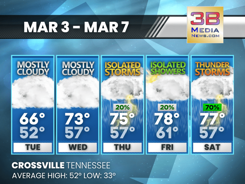
WARMING TREND WITH STORMS LATE WEEK
Temperatures climb well above average midweek before isolated showers and a few thunderstorms move in by Saturday. Tuesday: Mostly cloudy, with a high near 66. South
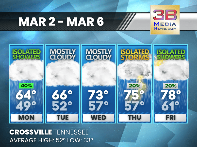
WARMING TREND WITH MIDWEEK STORMS POSSIBLE
Temperatures climb steadily through midweek with mostly cloudy skies before isolated storms arrive Thursday and scattered showers linger into Friday. Today: A 40 percent chance of