
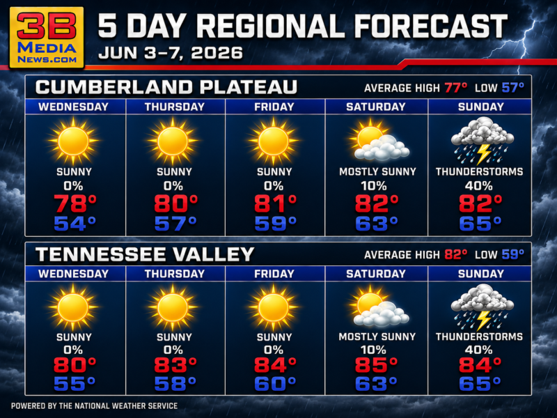
SUMMER HEAT ARRIVES WITH SUN AND STORMS
Regional Forecast — Cumberland Plateau & Tennessee Valley A stretch of dry weather remains in place through the end of the workweek with plenty of
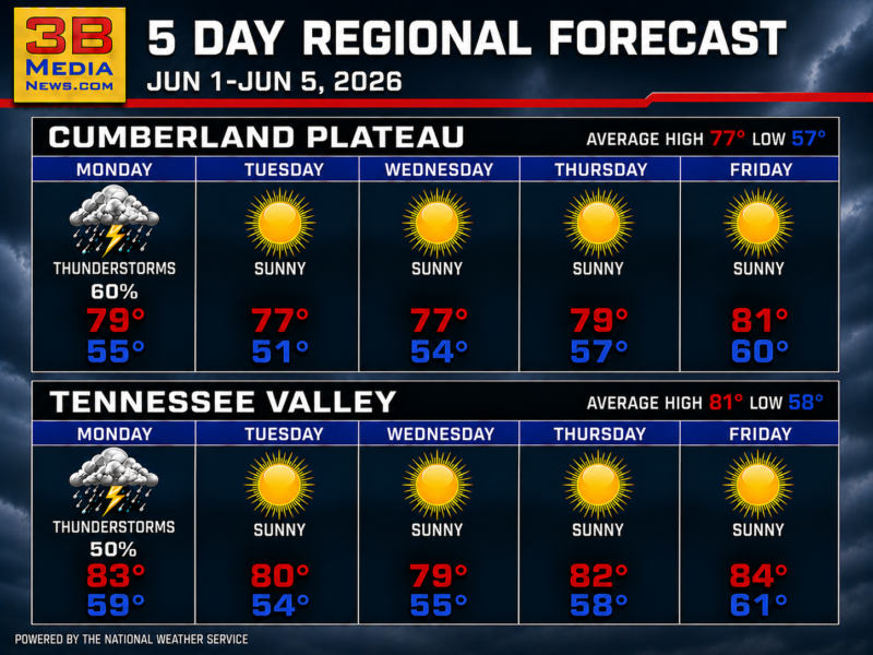
SUNSHINE TAKES CONTROL ACROSS THE REGION
Regional Forecast — Cumberland Plateau & Tennessee Valley After a stormy start to the week, a stretch of dry weather and gradually warming temperatures settles
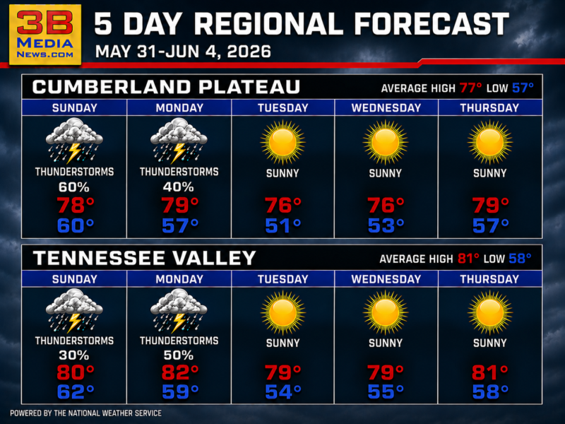
SUNSHINE TAKES CONTROL AFTER EARLY STORM CHANCES
Regional Forecast — Cumberland Plateau & Tennessee Valley After a couple of days with scattered thunderstorms, a stretch of sunny weather and cooler nights settles
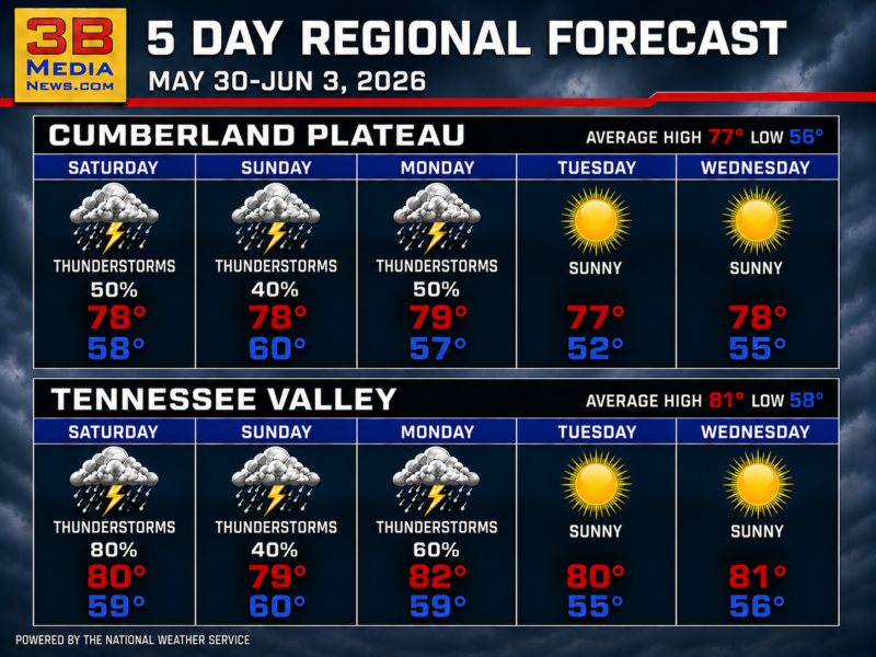
STORMS LINGER BEFORE A BRIGHTER PATTERN EMERGES
Regional Forecast — Cumberland Plateau & Tennessee Valley Daily thunderstorm chances continue through Monday before sunnier and cooler weather settles into the region during the
STORMS DOMINATE THE REGIONAL FORECAST THROUGH EARLY NEXT WEEK
Regional Forecast — Cumberland Plateau & Tennessee Valley Daily thunderstorm chances remain in the forecast across the Cumberland Plateau and Tennessee Valley, with the wettest
STORMS DOMINATE THE REGION THROUGH THE WEEK
Regional Forecast — Cumberland Plateau & Tennessee Valley Repeated rounds of thunderstorms and cooler late-week temperatures will keep conditions unsettled across the region for several
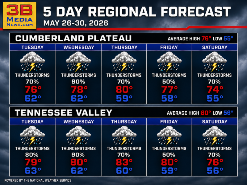
STORMS DOMINATE THE WEEK ACROSS THE PLATEAU AND VALLEY
Regional Forecast — Cumberland Plateau & Tennessee Valley Repeated rounds of thunderstorms and heavy rain chances will keep conditions unsettled for much of the workweek,
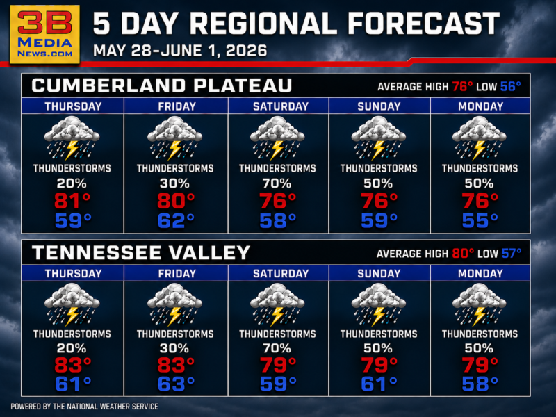
STORMS DOMINATE THE HOLIDAY WEEKEND FORECAST
Regional Forecast — Cumberland Plateau & Tennessee Valley Repeated rounds of thunderstorms are expected across the Cumberland Plateau and Tennessee Valley through midweek, with heavy

STORMY HOLIDAY WEEKEND TAKES OVER THE REGION
Regional Forecast — Cumberland Plateau & Tennessee Valley Repeated rounds of thunderstorms are expected across the region through midweek, bringing heavy rain chances and little

TORNADO WARNING ISSUED FOR CUMBERLAND, PUTNAM, AND WHITE COUNTIES
The National Weather Service has issued a tornado warning for portions of Northwestern Cumberland, Central White, and Southeastern Putnam Counties in Tennessee. The warning, which
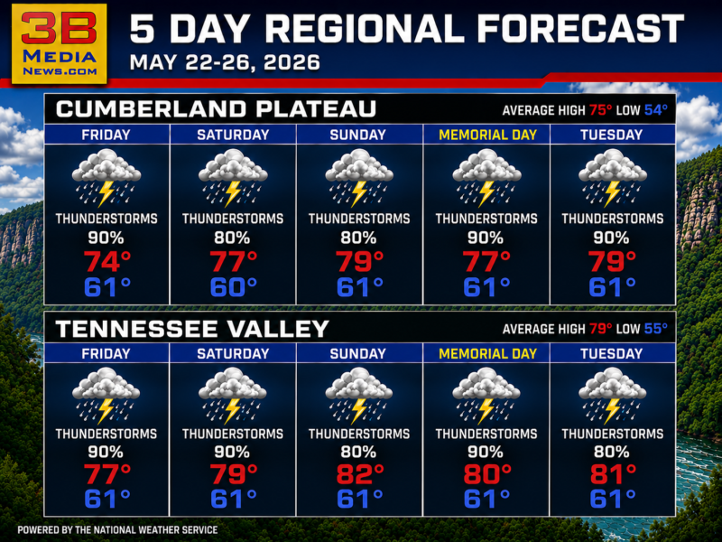
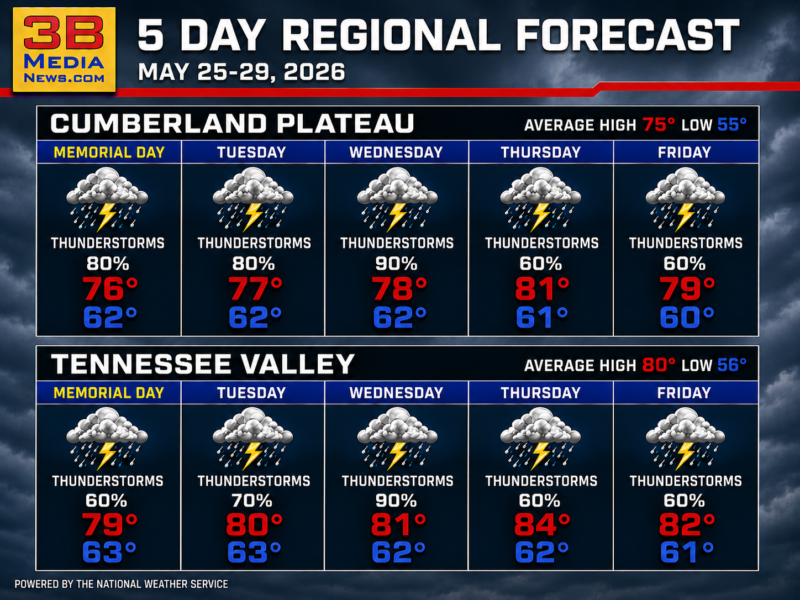
MEMORIAL DAY WEEKEND BRINGS ROUNDS OF STORMS ACROSS THE REGION
Regional Forecast — Cumberland Plateau & Tennessee Valley Thunderstorms and heavy rain chances remain high through the holiday weekend and into Memorial Day, with warm
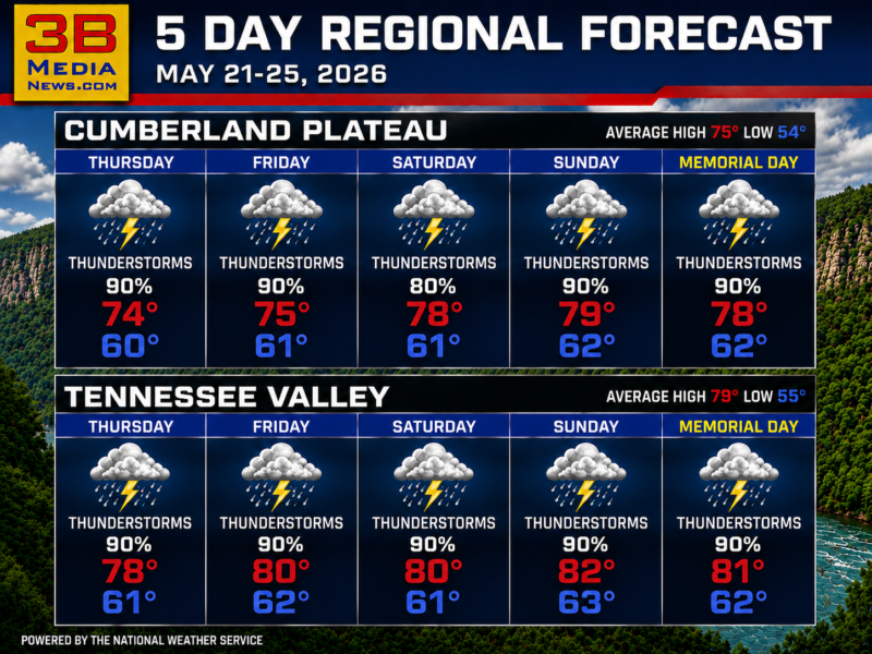
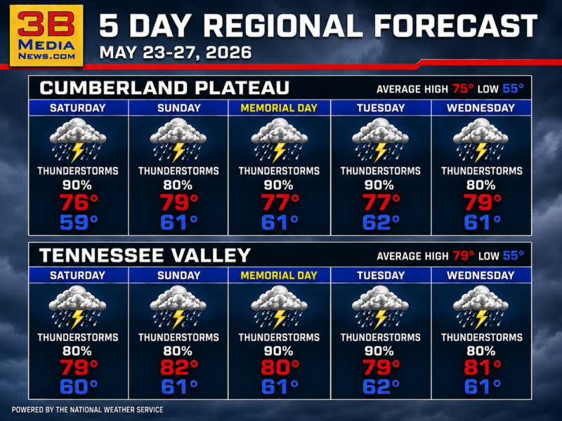
FIVE-DAY THUNDERSTORM ALERT ACROSS REGIONS
Regional Forecast — Cumberland Plateau & Tennessee Valley Widespread thunderstorms are expected across the Cumberland Plateau and Tennessee Valley through Memorial Day. Thursday: Showers and