
NATIONAL WEATHER SERVICE: TORNADOES POSSIBLE IN COVERAGE AREA EASTER NIGHT
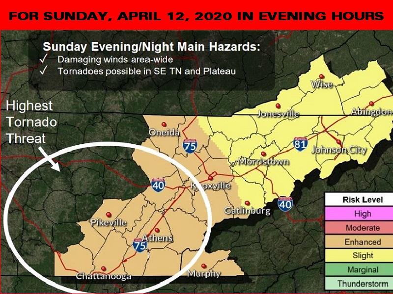
The National Weather Service there is a high threat for tornadoes in parts of the coverage area late tomorrow afternoon into the evening hours (Sunday, April 12, 2020). The weather service added the storms could bring damaging winds, hail, frequent lightning and flooding. As of now, the timing of the storms on the plateau appears to be between 4 and 8 p.m. central time tomorrow and in the valley between 6 to 10 p.m. eastern time. The timing track can and will be fine-tuned tomorrow morning. 105.7 News will do a story tomorrow morning with the updated times of arrival.
105.7 The Hog Staff Meteorologist Steve Norris says this is the highest threat of severe weather so far this season. “Everything is coming together weather wise for a severe outbreak tomorrow and it could be the worst we have seen this year in the area.”
Please remain weather aware tomorrow and into early tomorrow night. A weather radio or a weather app such as WeatherBug, Storm Shield or AccuWeather on your phone alerting you to a watch or warning is highly recommended. Also stay tuned to 105.7 The Hog or 98.9 The Wolf for any watches or warnings issued tomorrow by the National Weather Service.