
SUNNY MIDWEEK WARMTH TO GIVE WAY TO A SHARP WEEKEND COLD FRONT
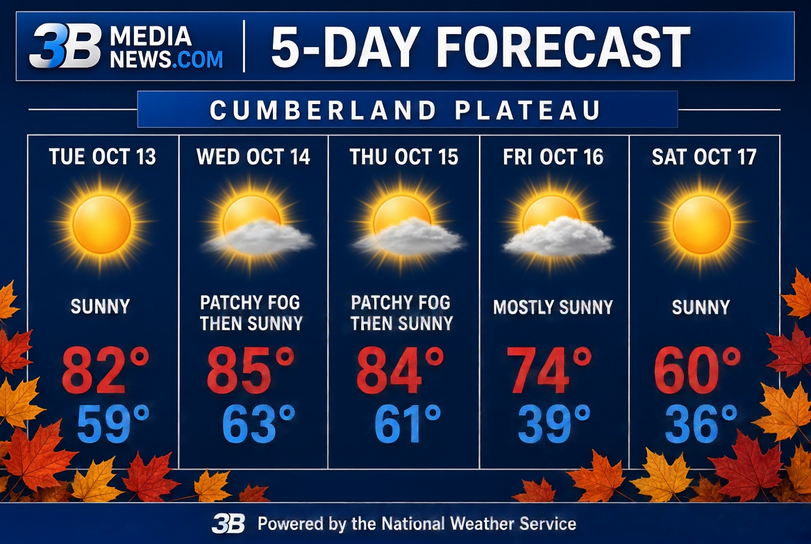
Residents are in for a bright and warm stretch through the middle of the week before a strong cold front brings a major temperature drop and breezy conditions by Friday night.
Midweek Warmth & Morning Fog
Sunny skies will dominate today through Thursday, with afternoon highs climbing into the mid-80s—peaking around 85°F on Wednesday. Winds will remain light, mostly around 5 mph. Early morning commuters on Wednesday and Thursday should watch out for patchy fog before 8:00 AM, which will quickly clear to give way to full sunshine. Overnight lows will stay mild in the upper 50s to low 60s.
Friday Cold Front Shift
The weather takes a dramatic turn on Friday. While the day starts mostly sunny with a high near 74°F, winds will pick up out of the west at 5 to 15 mph, shifting north-northwest in the afternoon with gusts reaching up to 25 mph.
Chilly Weekend Ahead
Temperatures will plunge Friday night to a low around 39°F under partly cloudy skies, accompanied by brisk northerly winds gusting up to 25 mph. Saturday remains bright and sunny, but crisp—highs will struggle to reach 60°F before temperatures drop into the mid-30s overnight.
