
STRONG TO SEVERE STORMS POSSIBLE IN COVERAGE AREA
The National Weather Service says a few strong to severe thunderstorms will be possible tonight in the coverage area.
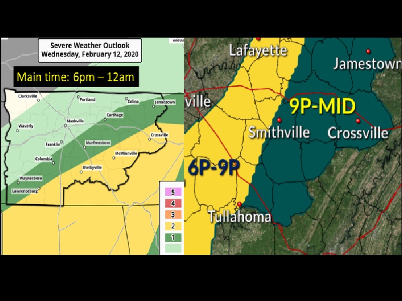
Showers and thunderstorms will be on the increase today. By this evening, strong to severe thunderstorms will be possible, mainly across southern middle Tennessee and the Plateau.
Damaging winds and an isolated tornado or two will be possible. Additionally, given the already wet conditions, flash flooding and the flooding of rivers and streams is very likely. Nearly the entire state is under a flood watch or flash flood watch.
The timing of arrival for the severe weather on the Plateau ranges from 9 p.m. central to midnight and in the valley from 11 p.m. eastern to 2 a.m.
Once the storms pass, tomorrow will see a return to winter as the temperatures will fall throughout the day. Tomorrow night’s low is projected at 20 degrees on the Plateau. The high Friday is forecasted to be only 35 with a low again of 20. Saturday will see a gradual increase of the high temperature going back into the mid 60’s by next Tuesday.