
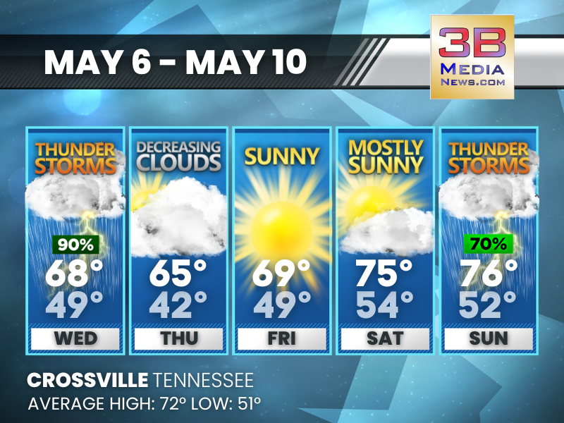
STORMS BOOKEND A MILDER, BRIGHTER STRETCH
Rain chances give way to a run of sunshine and seasonable warmth before storm chances build again. Wednesday: Showers and possibly a thunderstorm. High near 68.
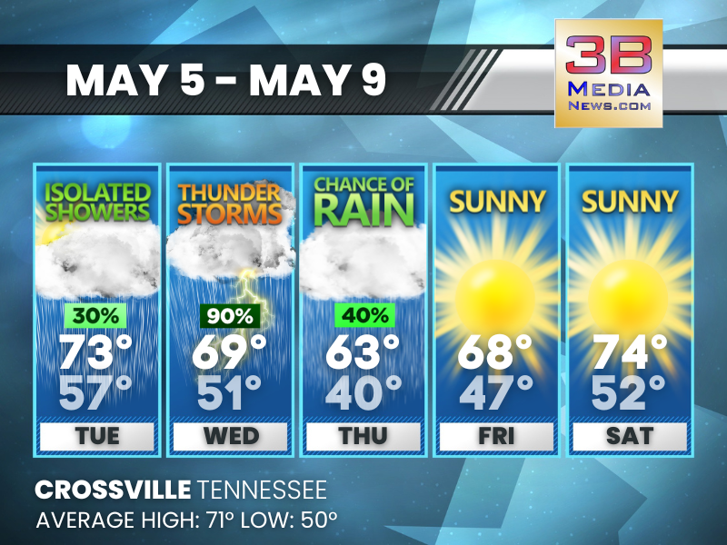
MIDWEEK STORMS, WEEKEND SUNSHINE
Rain and thunderstorms keep temperatures cooler, while sunnier skies bring a mild warm-up later in the week. Tuesday: A 30 percent chance of showers, mainly after