

STEVE NORRIS FORECAST – SHOWERS, WIND, MUCH COOLER
A strong cold front will move across Tennessee during the day on Thursday bringing showers and a few thundershowers, our best chance of rain in a long time. Rain chances will continue Thursday night and then ending on Friday. The weekend is looking dry but chilly. High temperatures on Friday and Saturday will only be in the upper 50s and low temperatures in the upper 30s by Saturday morning. As the front passes Thursday night the wind will pick up from the Northwest with gusts up to 30 miles per hour and this will continue Friday putting a chill in the air! I will have hourly updates for you throughout the day and night as we track the strong cold front across the volunteer state
Related Posts
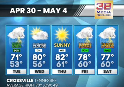
TUESDAY’S 5-DAY FORECAST
Thunderstorms are in the forecast, but no severe weather is expected across Middle and East…
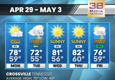
MONDAY’S 5-DAY FORECAST
Thunderstorms are in the forecast this week, but no severe weather is expected. Monday: Mostly sunny,…
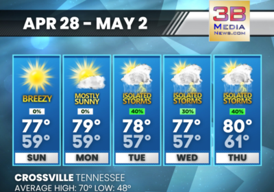
SUNDAY’S 5-DAY FORECAST
Dry through Monday, but then daily chances for at least scattered showers and thunderstorms through…